Les's Winter Weather Outlook 2008-2009
You’ve asked…. You’ve waited…. And now it’s here! Sit back, relax, and I hope you enjoy reading this Outlook. As most of you know, I have been researching what our upcoming winter may hold in store for us since July! This year’s Winter Outlook for the region will consist of what I think will happen from November 2008 through March of 2009.
October – The Month of Clues
October is a very important month of the year. A lot of clues as to what could happen during the upcoming winter are found during this month. You just have to look, and know what you’re looking for. So, I’ll start off this section of the Outlook revealing the clues and what they potentially could mean for us down the road.
ENSO State
The ENSO state of last winter was a Strong La Nina. We had a very strong Pacific Jet which brought us numerous storms throughout the winter season. We had a wide range of temps. as well. That is typical of a strong La Nina. Thus, predicting what would happen last winter was actually fairly easy. This year, however, is going to be much more difficult. One of the reasons why, is that the Pacific is not going to dominate the pattern. The Atlantic will have a much more important say in how things go. We’ll get to that in the NAO section in a little while. Currently, we are seeing ENSO Neutral conditions, meaning that the sea surface temps. in the Equatorial Pacific are neither cooler nor warmer then normal. In regards to this years ENSO state, I am expecting us to be in a Weak La Nina. There are many factors that are pointing to this.
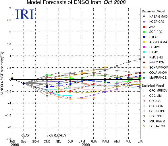
First, let’s start off with what the models are saying. Below, you will see the latest run of the climate models and their predictions for what ENSO will do. As you can see by the graphic, the models are clustered around a weak La Nina status.
Now, let’s see what the Sea Surface Temps. (SST’s) are doing in the Equatorial Pacific. Below, you will see an animation of the SST’s for the past 6 months.
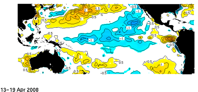
We have been in ENSO Neutral conditions for a while now, but look at how the SST’s drop on the last few frames. Whether my ENSO call is right or wrong, it really doesn’t matter. The atmosphere is still acting like we are in a La Nina anyways.
PDO – In a Strong Negative State
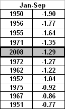
Another factor pointing to a weak La Nina is the phase of the PDO. When the PDO is in a cold or negative state, we typically see more La Nina’s then we do El Nino’s. Thus far, 2008 ranks as #5 in the strongest negative PDO states since records on this were kept beginning in 1950 for the Jan. through Sept. period.
When looking back at snowfall data in the classic winters of the 60s and 70s, one of the factors was that we saw more La Nina’s and the PDO was in a negative state.
QBO
The QBO, which has been running strongly positive, is now trending back towards negative, although very slowly. The current QBO index value for Sept was 11.62. I expect that we should see weakly positive or even neutral by early 2009. This is more good news for those of you wanting a colder and snowier winter then avg.
NAO
As most of you know who follow the weather a lot or have read my outlooks in the past, you know that the NAO in a negative state favors colder and stormier weather for the Eastern US. However, this has a bigger impact on the East Coast then it does for us. The NAO has been primarily negative for most of this year, minus September and October. This is a GOOD THING though. There is a lot of data out there that I have read, which suggests that 80% of the time, when the NAO averages out to be positive in Oct, then it’ll be negative for the winter. For those classic winter storm tracks to ride up the Appalachian Mountains, we want the NAO to be weakly negative or neutral. In my opinion, if the NAO is too negative, then the storm will track up the East Coast, as the high around Greenland would steer the low pressure tracking in that fashion. Thus, we are cold and dry and miss out. If the NAO is too positive, then the blocking high is too far west, and we get a system that tracks well to our West and we are either warm and dry, or get rain out of it. For this winter, I expect the NAO to be positive at times and strongly negative at other times. So, when you average it all out, it should average weakly negative or pretty close to neutral. This is pretty good in terms of snowfall and cold air potential for us here in the Ohio Valley.
PNA and EPO
La Nina’s and negative PDO’s tend to favor the PNA being in a negative state. This is not good news for us, in terms of getting sustained cold and snow. However, this go around, I do not believe this to be true. I think the opposite will happen. A cold pool of air is building in the Northern Pacific (-PDO) So, that favors a trough up there. Downstream, you have to have a ridge, correct? Yes. So, that would place a ridge near the West Coast. Then, you have to have a downstream trough, correct? Yes. That would place the trough over the Central and Eastern US. Another factor in getting the arctic air down into the Eastern US is for the EPO to be negative. For a while now, it has been running positive. That is one factor in why we have had a warm Aug and Sept. However, there are signs that the EPO is going negative. So, there are more good signs if you like the cold air for the upcoming winter season.
Solar Minimum
The solar activity, or lack thereof, has been a huge weather story for 2008. I don’t have a lot of time to go into much detail here, but for further information, I suggest going to
http://www.spaceweather.com to get the latest information on the sun spot activity. To sum up what I have been noticing is this… Records on the suns activity have been kept by NASA since the 1960s. So far in 2008, we have seen very low sun spot activity. The solar winds have dropped by 30%. What this means is, we have been seeing less energy being put out from the sun. The arctic air masses that are building in Alaska and Northern Canada are going to be able to build earlier then usual as well as be colder then usual. Nothing is more evident then looking at Alaska’s weather. I have seen record breaking cold occurring for Oct already! Lows around 20 below zero have been occurring up there for the past week. Fairbanks has had a very chilly October thus far as well. It has been the coldest Oct. so far in the last 15 or 20 years!
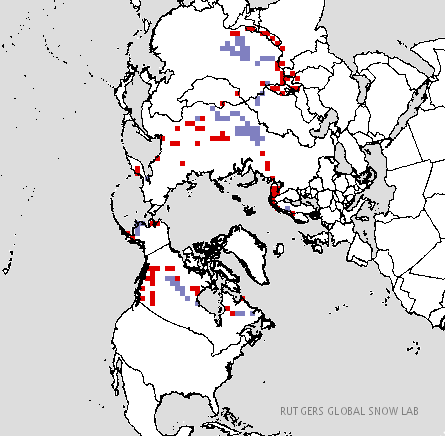
Arctic Sea Ice and Snow Cover
As I have talked about before, the faster the snow cover and arctic sea ice can form, the colder the air masses will be when they build up in Alaska and Canada. We are already seeing this take place. Here is the current arctic sea ice and snow cover picture:
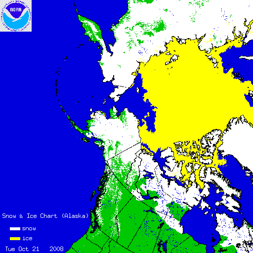
How are we doing compared to what we typically see this time of year?
We are a little behind in the snow cover dept. but we will see more and more positive anomalies over the next month, so we are looking good there. Arctic Sea Ice production has increased and continues to increase at a rapid rate! This is wonderful news here!
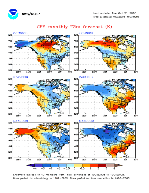
What is the CFS Climate Model Saying?
The CFS Climate Model predicts a cold, Nov – Jan period.
Putting it All Together – What Does This Mean for the Ohio Valley?
So, now that I have some of you confused, what does all this mean for the OH Valley? I expect this winter to be in the form of two bookends so to speak. What I mean is, I expect winter to come early, meaning Nov and Dec should be colder then avg. Then, in January, I expect to see the classic “January Thaw” occur, but don’t let this fool you. I expect winter to come back for Feb. and March. I expect a delayed spring like we saw this year when March was cold.
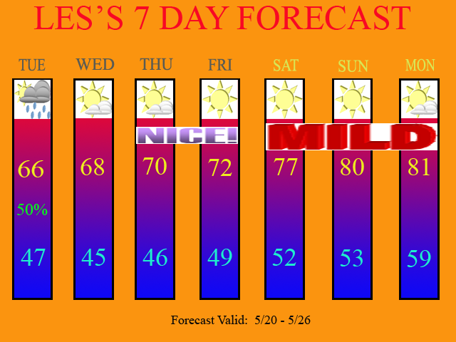
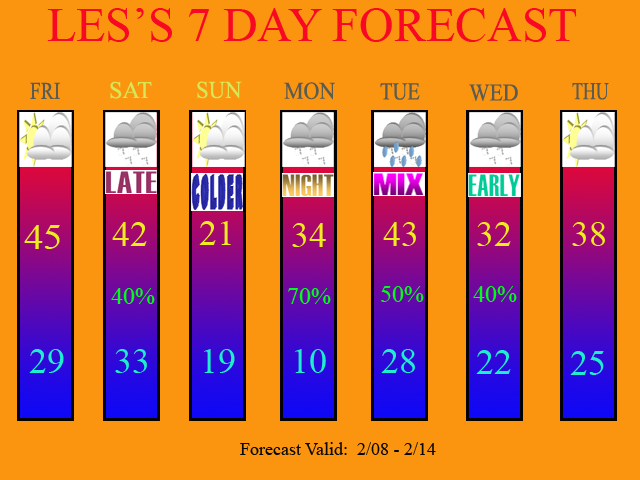
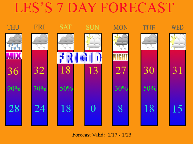
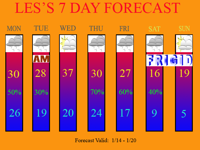
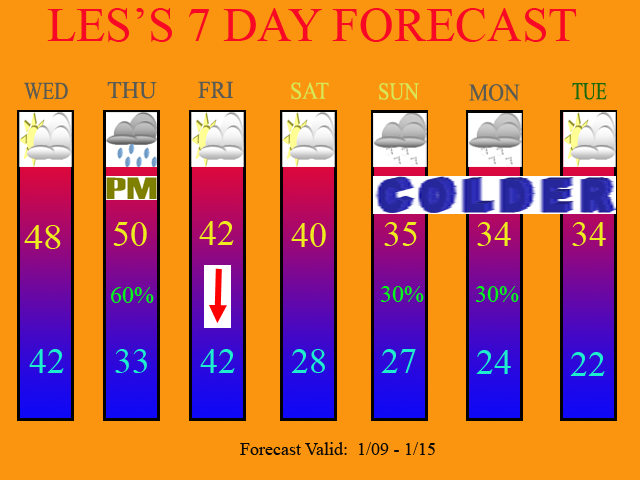
Monthly Break Down of Temps. and Snow Fall Amounts for KCVG
Nov – Below Avg for temps. and above normal for precip.
I expect the month of Nov to produce our first measureable snowfall for the winter season. We only avg 1.3” of snow for Nov. so getting any accumulation during the month is pretty much normal to above normal depending on how much we receive. I believe 2-4” of snow for the month is not out of the question.
Dec – Well below avg temps. and normal to slightly below normal in precip.
I expect Dec. to produce very cold conditions. Brutally cold weather and frequent arctic outbreaks will be the rule for this month. I expect to see numerous clipper systems affecting the region during Dec. I went with slightly below avg to near normal for precip. due to us a lot of the time having a cold, dry air mass in place. We avg. 3.7” for Dec., but since a lot of the precip. in Dec. should be in the form of snow, I expect snowfall to be above avg. here as well with amounts of 7-12” for the month as a whole possible.
Jan – Normal Temps to slightly above and above normal precip.
This is the month when I expect to see the pattern flip from cold to mild. We should have a chance at getting a good sized snow event or ice event here when the pattern decides to flip. We will see rain storms this month or mixed precip events at times as well. We avg. 7.9” for Jan. but due to the pattern change, I expect below avg. snow for the month of Jan in the 3-6” range.
Feb – Below Avg Temps and above normal Precip
Winter will make a come back in the month of February. Another good sized snow event is possible here when the pattern flips back to cold. Depending on when the flip occurs will impact the temp. and snow amounts that we receive. I am expecting slightly above normal snowfall here though. We avg. 6” for the month and I am expecting 6-9” for Feb.
March – Below Avg Temps and above normal precip.
Like this past March, I expect March of 2009 to be similar in terms of colder and wetter then avg. I think we have another chance here at a good sized snow event during the first half of the month. We avg. 3.8” and I expect normal to slightly above normal in terms of snowfall. I am forecasting 3-5” for March.
CVG Seasonal Snowfall Avg: 23.7”
Les’s Snowfall forecast: 21-38”
Target Number: 29.5”
The reasons why I have such a wide range of snow amounts listed are because snowfall is so difficult to forecast. One or two big storms can blow these numbers out of the water! My target number is 29.5” or 30” basically for KCVG. This is well above our normal of 23.7”.
I found the snowfall information here:
http://mcc.sws.uiuc.edu/climate_midwest/historical/snow/ky/151855_ssum.html
Conclusion
In conclusion, I expect temps overall for the entire winter season to be below avg. and precip. as well as snowfall to be above avg. for KCVG. What may make this forecast bust on the high side is if the NAO is too negative, and we see a suppressed storm track to the South and we get mainly clipper systems and lack of deep moisture that is needed for bigger snows. Also, a lot of storms would be Nor’ Easters instead of Appalachian tracks, which is what we like to see here. (March 2008 Blizzard for example). My forecast could also bust on the low side as well. Another idea I have been toying around with in my mind has been to take the record setting snowfalls of the Upper Midwest last year (WI, IL, MI, etc.) and shift that storm track a few hundred miles South. That would put us in the sweet spot here! Thus, 40-50” of snow would be possible in this scenario. So, I took a blend of both ideas and there you have it.