Monday, April 30, 2007

A Warm Last Day of April - Severe WX Threat for Tuesday

4/30/07 5:45am

Good morning everyone!

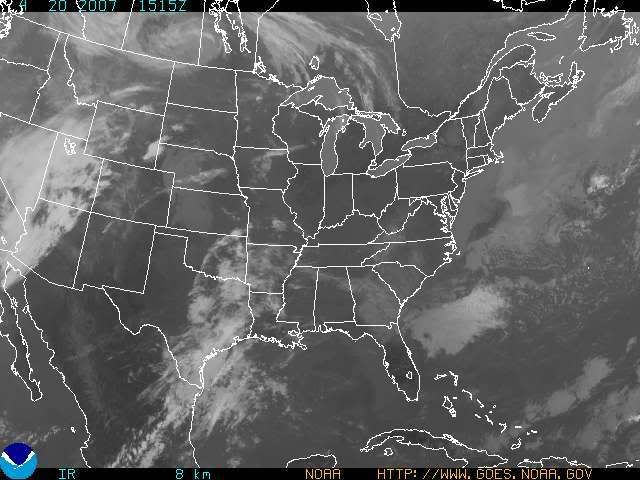
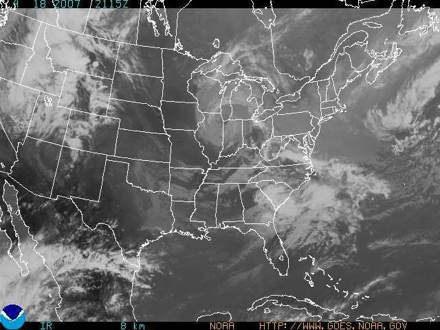
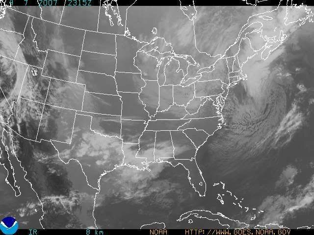
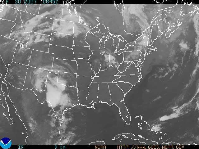
Well, I almost made it through April without an 80 degree temp. at CVG when I made the prediction back on April the 5th. I guess it's proper to have it bust on the last day of the month! All in all though, it was still a great prediction, and to me, it stands out as one of my best long range predictions that I have made in a long, long time. The GFS MOS guidance, shows a high of 83 today, which I agree with. I have posted a satellite image below. As one can see, there is some high cloudiness roaming through the Northern parts of the Tri-state from T-storm blow off. Those clouds will be gone in the next hour or two, leaving most of us with wall-to-wall sunshine for the majority of the day.

Photo Sharing and Video Hosting at Photobucket

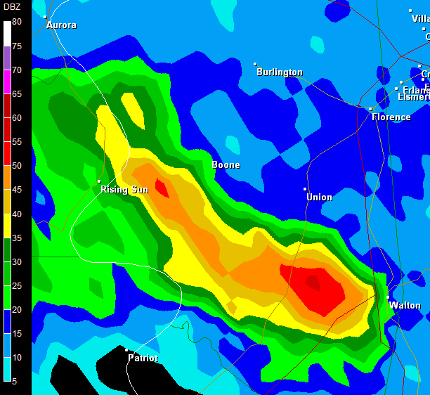
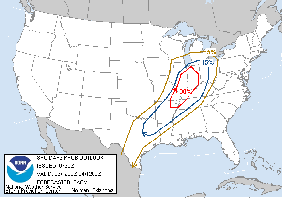
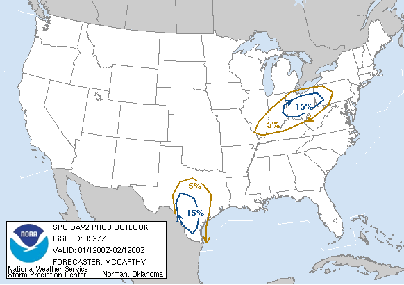
For Tues. there will be a slight risk of severe wx. The surface based CAPES will only be at 1000 j/KG for Cincinnati, with a lifted index of -4 in the afternoon. Both the 0Z NAM and GFS have the front coming through here Tues. evening after 8 or 9pm. The NAM and GFS both have come down on precip. chances for Cincinnati. Thus, I am downplaying the severe threat for us. Right now, I am going for an isolated severe storm with the best chance being along the I-70 Corridor running from Dayton to Columbus.

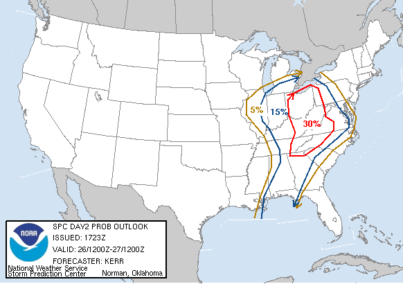
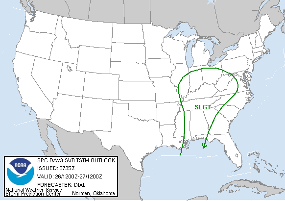
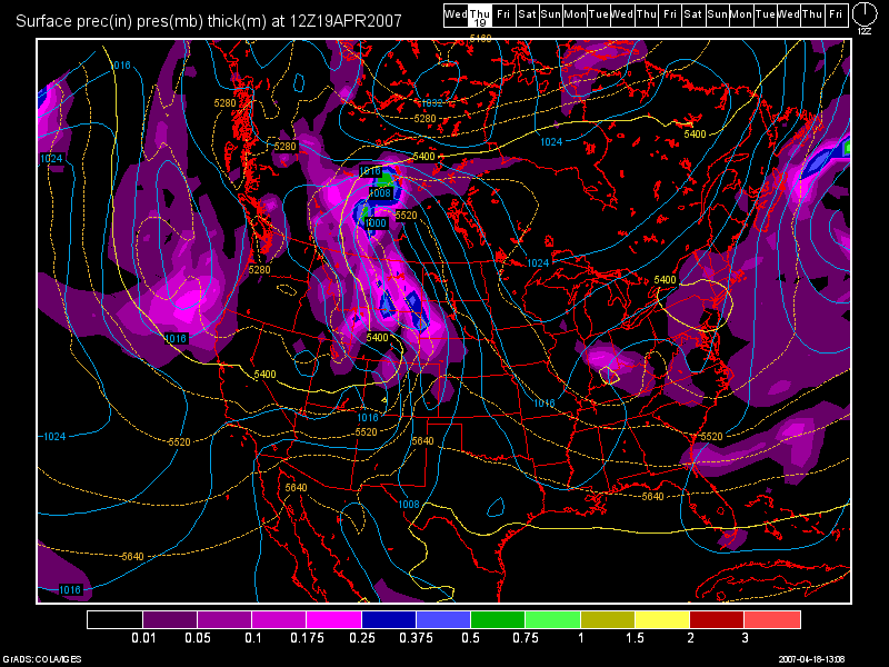
The SPC Day 2 Outlook graphic is below, which I think illustrates by prediction beautifully.

Photo Sharing and Video Hosting at Photobucket

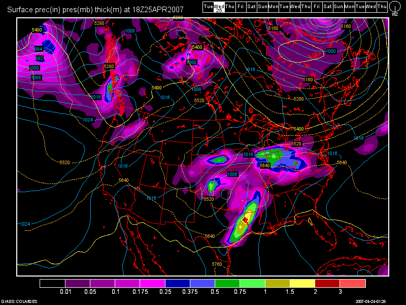
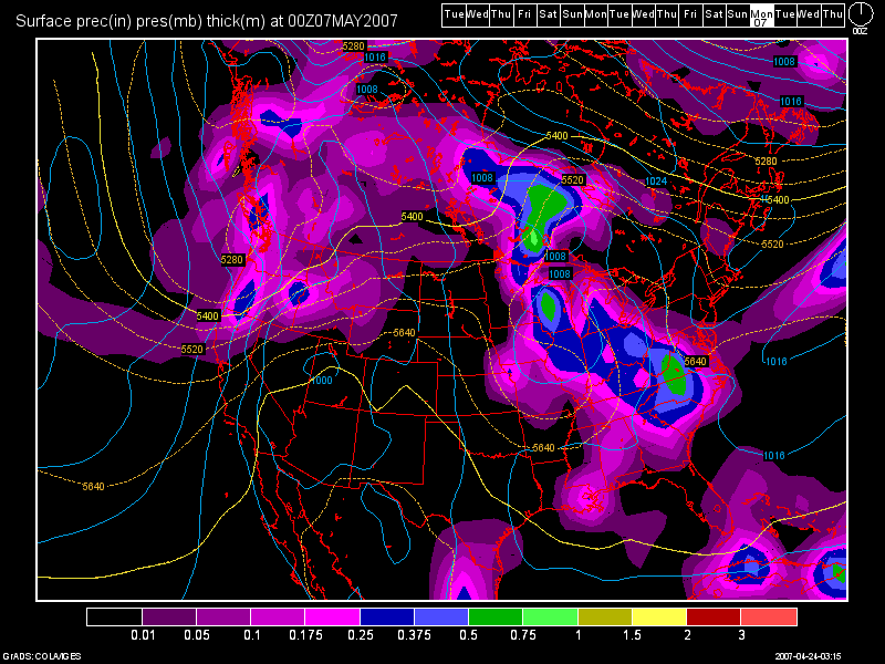
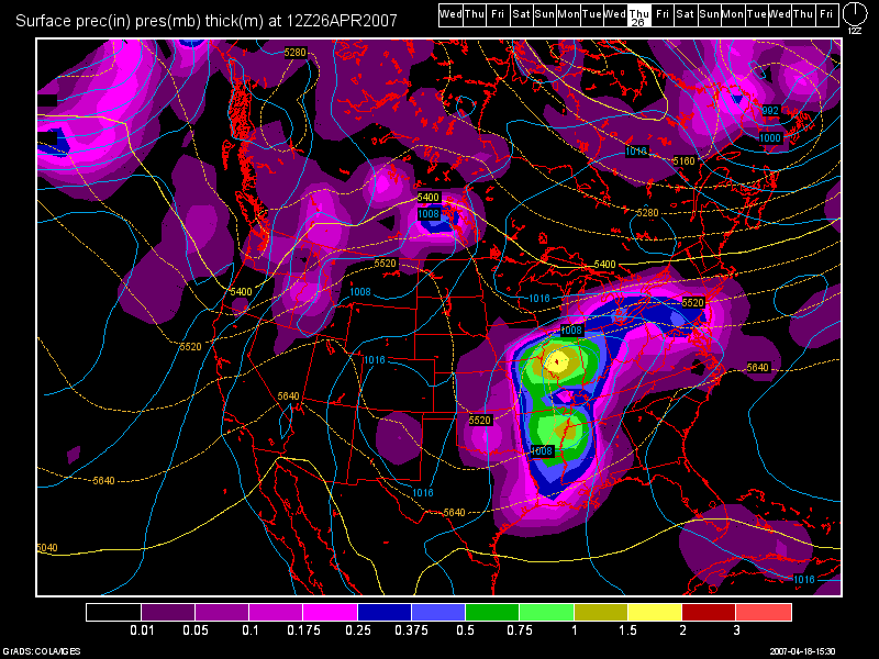
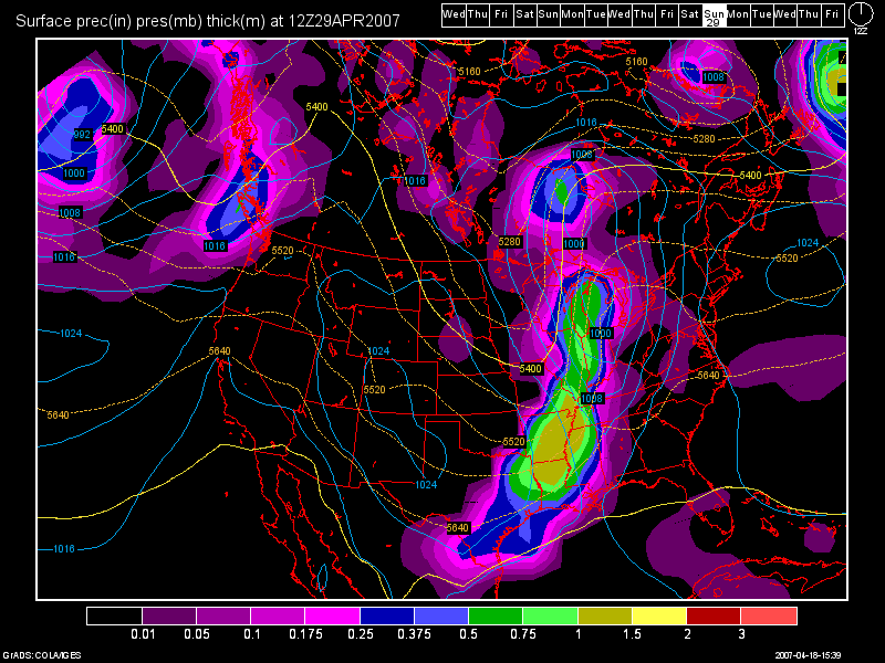
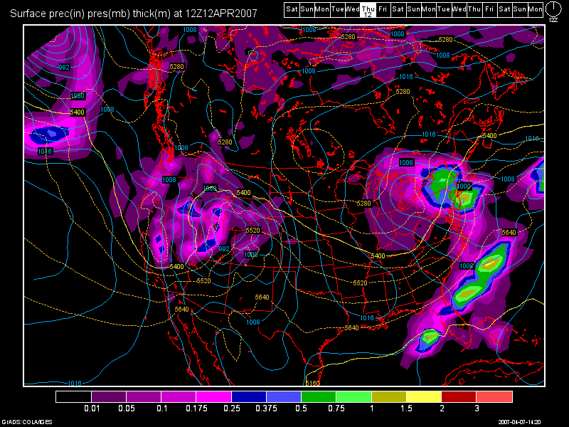
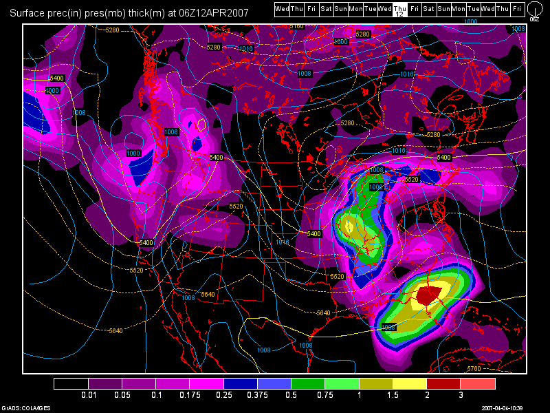
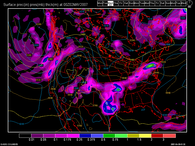
Here's the 0Z GFS model run valid at 48 hours: (Tues at 8pm)

Photo Sharing and Video Hosting at Photobucket

After this system moves through, Wed - Fri. looks to be dry, although cooler since we'll be under a NW flow aloft. Temps. will drop from the 80s on Tues. down into the upper 60s for Wed. then around 70 to the lower 70s for Thurs and Fri.

By the time we hit next weekend, at this time, it looks to be unsettled in the OH Valley. I've been watching the model runs daily as I know there are a lot of activities planned for that weekend. Here in Cincy, the Flying Pig Marathon will be happening, and right now, my forecast calls for a 30% chance of a T-storm with highs in the 70s. Now, a ridge of high pressure will be building down from the Great Lakes by weeks end, and if it pushes far enough South, and if the front can push itself far enough South, then for the Marathon, conditions could be dry. For the Walleye Tournament on Lake Erie, right now, I am calling for dry conditions all weekend with NW Winds. Highs up there should be in the upper 60s on Sat to the lower 70s on Sun under sunny skies!

Long Range Outlook: (May 6th - May 15th)

Conditions during the long range period look to be fairly mild across the region. A cold front is forecast to come through the region on May 9th, but it looks weak at this time. A stronger cold front looks to affect the region around the May 12th time frame.

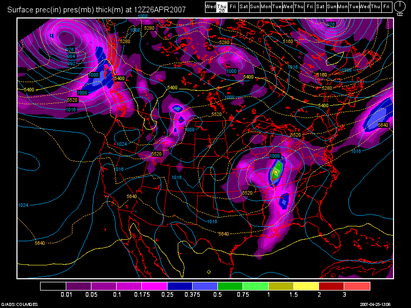
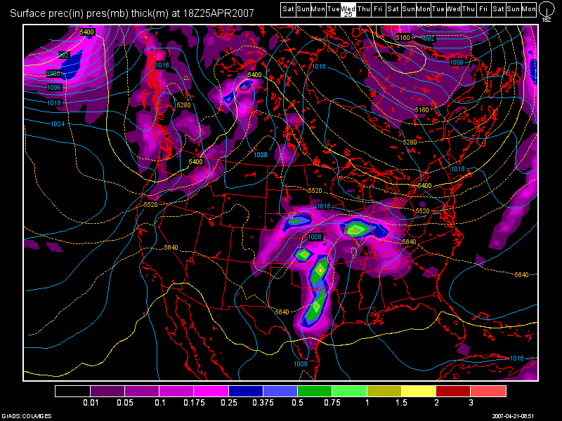
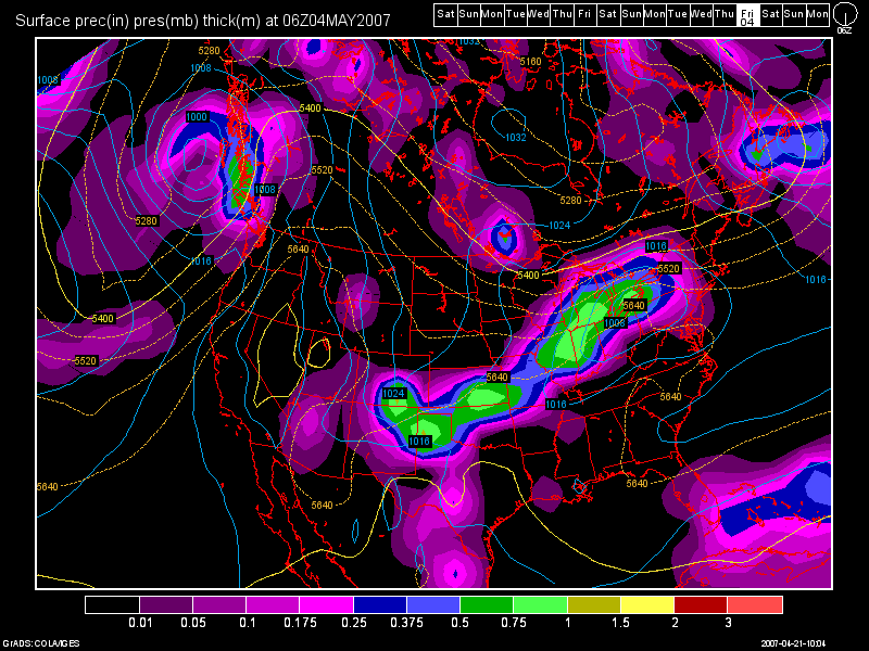
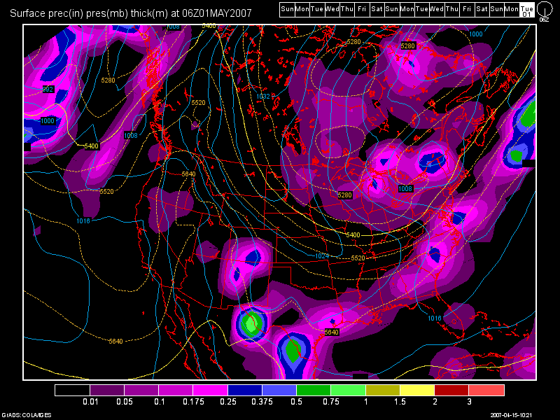
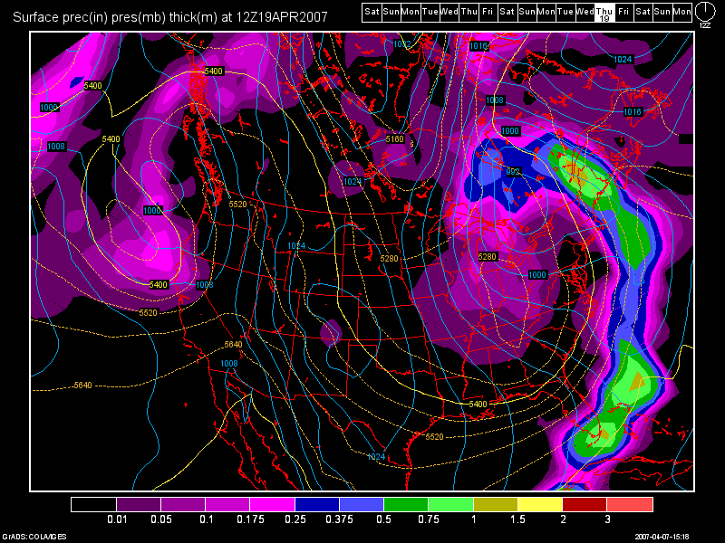
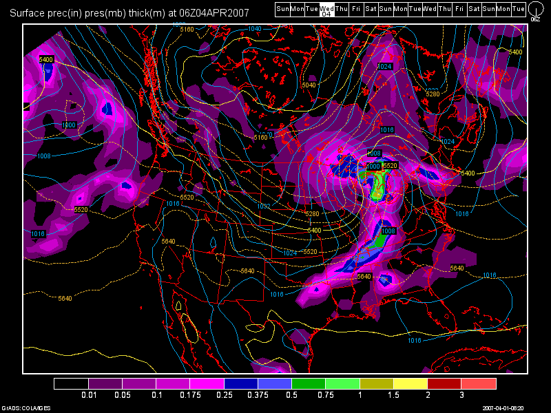
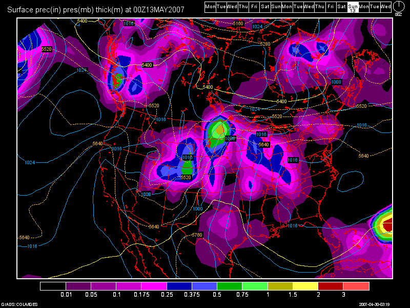
Here's the 0Z GFS Model Run image below valid at 312 hours: (Sat., May 12th at 8pm)

Photo Sharing and Video Hosting at Photobucket

Then, another front could affect the region by the end of the long term period.

Wednesday, April 25, 2007

Special Edition: Severe Weather Threat for Thursday

04/25/07 7:20pm

Good evening folks!

I am updating the blog tonight due to our severe wx threat for tomorrow. But, before I get to that, I'd like to first off, start by telling everyone that I am now on high speed Internet access here at the Burlington Weather Office!!! I'd like to thank my family for making that possible! In addition to that, another upgrade also took place. I am now running GR Level 3 Radar too! This radar allows me to look at a T-storm's attributes, such as hail size, rotation, clouds tops, etc. I'd like to thank Anthony, Jerry, Nick, and Trevor for that!

Below, I have posted a GR Level 3 image of a weak T-shower that moved into Boone Co., KY last night around 10pm.

Photo Sharing and Video Hosting at Photobucket

Now... on to tomorrow's severe wx threat.

First off, here's the latest severe weather probability map from the SPC:

Photo Sharing and Video Hosting at Photobucket

As one can see, the best chance looks to be along and to the East of the I-71/I-75 corridor. I agree with this map for many reasons:

1) If the 12Z GFS Model solution verifies, it shows the surface low pressure area tracking off to our NW. It also, shows some morning convection moving thru which should help to destabilize the atmosphere. I have posted the model image below for Thurs. morning at 8am.

Photo Sharing and Video Hosting at Photobucket

2) Surface Based CAPES are only going to be between 1000-1500 j/kg. That is an ok amount of instability, but I'd rather see values over 2000.

3) The Lifted Index, currently anyways, is only at -2 for Cincinnati. That tells us that we do have a little bit of lift going on in the atmosphere, but I'd rather see values even lower, such as -4, -5, -6, etc.

4) The shear values do actually look good. That is forecast to be between 30-40 knots. That's not bad at all for wind shear in my opinion, so we do have that going for us.

In short, it'll depend on if the morning rains move thru here, and how long it lasts. Also, will it remain cloudy, or will the skies clear out fast enough for the sun to destabilize the atmosphere again? Based on the above images, and above model data that I have shown you, I agree with the SPC and right now, we all stand a shot at seeing severe wx tomorrow afternoon and evening. BUT... the greatest threat area to me will be SE and E OH, WVA, and NW PA. This includes cities such as Columbus, Huntington, and Pittsburgh.


After this storm moves out, we may see a leftover shower Fri. morning, but otherwise the weekend thru Tues. of next week is looking beautiful! I see dry skies and highs in the 70s, warming POSSIBLY into the lower 80s next week!

I'll talk about that in my next blog entry. This one was mainly designed to talk about the severe wx threat for tomorrow.

Tuesday, April 24, 2007

Heavy Rain Possible Wed and Thurs - Weekend Looking Nice

4/24/07 7:15am

Today looks to be another nice day as we should see some sun this morning followed by increasing clouds this afternoon. Highs should be between 72-75 degrees depending on the amount of sun we receive.

Both the 6Z NAM and 0Z GFS are in agreement on rainfall pushing into the region after midnight tonight. A cold front, which is currently stalled out just to our South over Central KY, is forecast to move back North as a warm front in response to surface low development in the Plains today. This should cause another severe wx outbreak there today. For us, rainfall should move in after midnight tonight in response to the warm front. A few T-storms are also possible, although severe wx to me should be non-existent. The models are also tracking the low to the North of our region over Northern IN and Northern OH. Heavy rain I think is our biggest threat with this system. I think an inch of rain is possible area wide with localized amounts of 2" possible.

Here is a model image from the 0Z GFS run valid at 42 hours: (Wed. 2pm)

Photo Sharing and Video Hosting at Photobucket

As one can see, the warm front should be North of Cincinnati by then with the heavier rain affecting areas along and North of I-70. On Thurs., we should see another round of rainfall with the cold frontal passage coming in Thurs. night/early Fri. morning. Highs Wed - Thurs will be in the 60s due to the expected cloud cover and rainfall.

The SPC has us in a slight risk for severe wx on Thurs. We'll have to see how the dynamics look with this system when the front gets closer. I do not think we'll see a widespread severe wx event, as the front should lose some of its punch due to it slamming up against the strong SE Ridge.

Photo Sharing and Video Hosting at Photobucket

This weekend, at this point, looks to be dry, with highs on Sat. close to 70 and in the 70s on Sun.
As we start off a new work week, another cold front could affect the area by Tues. afternoon. Highs on Mon and Tues should remain in the mid 70s.


Long Term Outlook: (May 2nd - 12th)

Overall, we can expect above normal temps. to continue with a somewhat unsettled weather pattern continuing. During the long term period, one storm in particular looks pretty decent this far out on the 0Z GFS run. You'll see an image below, which is valid at 312 hours. (May 6th 8pm)

Photo Sharing and Video Hosting at Photobucket

Saturday, April 21, 2007

A Nice Weekend in Progress - Turning Stormy by Midweek

04/21/07 12:20pm

Good afternoon everyone! What a beautiful weekend that we have in progress! We have clear skies all across the OH Valley today and tomorrow as well. The temp. at CVG is already up to 69 degrees as of this post.

Check out the Satellite picture below. You'll see exactly where the ridge of high pressure is located. The SE US is under a nasty drought right now, with fire weather watches and warnings, plus dense smoke advisories are in effect in some places.

Photo Sharing and Video Hosting at Photobucket

My forecast high for today is 74 and 78 for tomorrow! Speaking of tomorrow, we'll be under mostly sunny skies then as well.

A weak cold front begins to descend upon the area on Mon. afternoon/evening. Until then, we can expect another decent day on Monday with highs in the middle 70s expected! Models have been in good agreement over the last several runs with both the NAM and GFS weakening the front and also stalling it somewhere in the OH Valley. I am inserting a slight chance of a shower or a T-storm with the front's arrival, but moisture does not look to be all that impressive with this front.

On Tues., the front will begin to lift Northward as a warm front. Tues. could be a dry day, but I'll leave a chance of showers and T-storms in the forecast at this point, due to model uncertainty in regards to the position of the front.

By Wed., a wave of low pressure will develop on the front and head our way. According to the 6Z GFS valid at 108 hours for Wed. afternoon at 2pm, it shows the precip. starting to move into the area with low pressure located in the panhandles of TX and OK and an area of low pressure riding along the front in ILL.

Photo Sharing and Video Hosting at Photobucket

Highs throughout the week will fall into the 60s as we progress thru the rest of the work week. Thurs. thru Sat. at least, I am going to continue to leave in a daily threat of showers and T-storms. Here is another 6Z GFS model image valid at 174 hours for Sat. morning at 8am:

Photo Sharing and Video Hosting at Photobucket

As one can see, the cold front is situated out in Indiana, and it should pass thru the region Sat, night. On Sun. we'll see clearing skies by afternoon with highs both days in the 60s.

Long Range Outlook (April 30th - May 7th)

As we begin the month of May, the models are currently showing a few dry days but by May 3rd-4th, another slow moving cold front will be dropping down across the Great Lakes region, and it should push into our region by Fri. night or Sat. (May 4th-5th):

Photo Sharing and Video Hosting at Photobucket

Temps. behind that system should drop into the upper 50s and lower 60s based on this model run. If we do not hit 80 at CVG tomorrow, then I believe my prediction of NOT seeing any 80 degree temps.will come true!


Finally, I'd like to make another announcement...

My friend Trevor who has the USA Weather Forum and Cincy Forecast website, is now doing his own VIDEO Weather Forecasts! The guy does a nice job with graphics and explaining the weather in a way that everyone can understand. Click on the link below to access his forecasts!

http://www.createforum.com/usaweather/viewforum.php?f=18&mforum=usaweather

Wednesday, April 18, 2007

Weekend Looks Like a Beauty - Stormy Weather to Return

04/18/07 6:20pm

FINALLY folks!!! It is coming! A beautiful Fri thru Sun period is in store for the Tri-state! Before I get to that, let's look at our current weather situation. We currently have an upper level low over the Great Lakes region. It is currently situated over the Great Lakes.

This satellite imagery tells the story:

Photo Sharing and Video Hosting at Photobucket

Then, as one can see by looking at the 12Z GFS valid at 24 hours, which is 8am tomorrow morning:

Photo Sharing and Video Hosting at Photobucket

This model is overdoing the precip. though, as it had moisture over us for today and we did not see a thing at all other than a few sprinkles in the Southern parts of the Tri-State, A loan T-storm also developed NW of Cynthiana, KY, today too. But, other then that, I am keeping isolated showers in the forecast for tonight and early tomorrow morning. With the expected cloud cover tomorrow, highs should remain in the 50s.

Now... Friday, begins our nice weather! A ridge of high pressure should expand from the Plains into the OH Valley. Highs on Friday will top out in the upper 60s with lower 70s for Sat. and maybe even 75 by sun! Lows thru the period should be in the 40s.

As we start the new workweek, a cold front will be sliding down from the Great Lakes region. It will stall out in our area and provide daily chances at showers and storms thru Wed.

Here is the 12Z GFS image valid at 192 hours for Thurs at 8am:

Photo Sharing and Video Hosting at Photobucket

Highs should still remain near normal to above normal through the Mon - Thurs. period.


Long Range: (April 29th - May 4th)

The stormy pattern will continue throughout the long range period. Here's another 12Z GFS image valid for Sat. April 29th valid at 264 hours.

Photo Sharing and Video Hosting at Photobucket

Beyond that cold front, the GFS continues to bring in storm systems as we head into the new month as well!

Sunday, April 15, 2007

Cool Weather Pattern to Continue - NW Flow Dominates

4/15/07 1:25pm

Hello once again everyone!

I hope everyone is having a nice weekend, although the weather once again has been terrible, with cold and clammy conditions. I lost power here at the Oregonia, OH, branch last night from 4 pm until 3:20 am! So, that's why the blog is being updated today.

Boy oh boy! We have a winter like weather map to talk about today! The NE States are expected to get up to a foot of snow in the interior areas over the next 2-3 days as a monster coastal low stalls out today thru Tues. of the upcoming week. Mountainous areas of the region could get totals exceeding 18" in the highest elevations! WOW!

What does that mean for the OH Valley though? It means NW Flow! Let me explain... the pressure gradient in the upper atmosphere is such that the monster coastal low to our East and at the same time, we have a big blocking high in the NW Atlantic Ocean, near Greenland, which is causing the storm not to be able to push out to sea very quickly. To our West, we have another ridge of high pressure pushing South out of Canada and it's taking up residence in the Plains. This type of jet stream configuration is known as an Omega Block, because it is shaped like the Greek Letter, Omega. This is where you have a trough in the west, a ridge in the plains, and another trough in the Eastern US, then a blocking ridge in the NW Atlantic. This type of weather pattern is slow to breakdown.

So, with that in mind, here in Cincy, we will be dominated in NW Flow. This will keeps temps. below normal, and chances at light precip. from time to time. As we begin the new work week, Mon and Tues. I am keeping dry at this time. A system will try and come into the region Mon,. night, but it's going to be moisture starved. The POP's are so low right now on the GFS, at 16%, that I am leaving the forecast dry until Wed. Highs for Mon should be in the lower 50s and for Tues the upper 50s. I am undercutting the GFS MOS guidance between 2-4 degrees for this forecast period.

Below, you'll see an image of our next system, which again is somewhat weak, but it does show a decent cold pocket aloft with it. A clipper-type low will dive SE out of Canada and move into the region by Wed. night and move out by Thurs. morning. GFS is too warm. I think North of I-70 a few snow showers mixing in could be possible, while everyone else sees scattered showers. This image is from the 6Z GFS run valid at 90 hours out for Wed. April 19th around 8pm.

Photo Sharing and Video Hosting at Photobucket

Highs on Wed. should top out in the upper 40s, and mid 50s by Thurs. I see a NICE Weekend finally for the Tri-state! Fri thru next weekend right now looks BEAUTIFUL as highs could crack 70 by Sunday!


Long Range Outlook: (April 23rd thru May 1st)

Models bring in our next slow moving, heavy rain making system into the region from April 24th thru possibly the 27th! Below is another 6Z GFS Model image valid at 240 hours for April 25th.

Photo Sharing and Video Hosting at Photobucket

Then, after this system moves out, we have another one due in at the end of the month. Here's one final 6Z GFS image valid at 384 hours for May 1st. Look at how far South the 540 line is! All the way down to us!

Photo Sharing and Video Hosting at Photobucket

As you have seen, this weather pattern shows no signs on breaking down at all. My prediction from the beginning of this month I believe are going to come true. No 80 degree readings at CVG until May! I made that prediction on 9th!

Thursday, April 12, 2007

Snow Possible for Sat. Morning - Unsettled Weather to Continue

4/12/07 7:20am

Well, ok... I busted on the severe wx event that we had yesterday. The T-storms were marginally severe with pea sized hail being most common in the reports that I read. Hail covered the ground in a lot of areas as well. For my particular county, Boone Co. in Northern KY, I saw none of this action. I did not bust for my county at least. The storms weakened as they moved through my area, then re-intensified as they moved to my North and East. I must have an "Anti Severe Wx Deflector Shield" up over my house or something.

The models have been trending much, much colder with our next precip. event for this weekend. The models are now in agreement in tracking a surface low pressure system through the TN Valley. This will result in a zero threat for T-storms and more of an E to NE flow with a steady rain. I also think that the precip. could start out as some wet snow briefly before turning over to all rain during the day on Sat. The further NE of Cincinnati that you are, the better chance you'll have at getting snow, versus areas to the SW. The 12Z NAM shows mainly snow on Sat. north of the OH River. That is a bogus model run! The 6Z NAM is in much better agreement with the GFS and the rest of the models. I checked the 0Z GFS model run and it too is in good agreement with the placement of the surface low track.

Here is an image of the 0Z GFS valid at 60 hours, which is 8am Sat. morning:

Photo Sharing and Video Hosting at Photobucket

High temps. on Sat. should be in the lower to middle 40s. For Sunday, we'll continue to see the 40s for high temps. as well with some morning snow showers and afternoon rain showers. The coverage will be spotty though, and I do not see any travel problems for the Cincinnati Tri-state.

As we begin a new work week, FINALLY, some nicer weather will return to the region. After the low moves through the TN Valley this weekend, it will deepen and stall out off of the New England Coast. This will result in a drier weather pattern for us Mon - Wed. of next week with highs in the upper 50s for Mon. warming into the lower to middle 60s for Tues. and Wed. I think for Wed. we'll see increasing clouds in the afternoon ahead of our next storm system.

Long Range Outlook: (April 19th - 28th)

I still see a relatively weak system for Thurs., the 19th. The 0Z GFS is not spitting out much precip. here at this point. After that, another system could affect our region around the 23rd, but at this point, most of the energy looks to be centered over the Great Lakes.

As we come to the end of the long range period, as I stated in my last blog entry, a slow moving heavy rain maker still looks to be in the cards for April 26-28th. I have included another 0Z GFS model run valid at 336 hours.

Photo Sharing and Video Hosting at Photobucket

Tuesday, April 10, 2007

Wet Times Ahead

4/10/07 7:15am

Wet times are ahead folks. The first system that I have to talk about is still our midweek system. To me, it looks like after midnight tonight, we should see some showers rolling in, with Wed. particularing looking like a washout at this point. The 6Z NAM model run shows about a third to perhaps a half of an inch of rain with this system, while the 0Z GFS shows about 3/4 of an inch to perhaps an inch in spots.

Here is an image of the 0Z GFS run valid at 36 hours, which would be Wed. morning at 8am.

Photo Sharing and Video Hosting at Photobucket

In my last blog entry, I talked about the system ending as some wet snow Wed. night and early Thurs. morning. That is no longer going to be the case. The precip. will remain all rain with this system. Instability also looks to be very poor, so no T-storms this go around, just a general moderate rainfall event. Highs today will top out in the middle 50s and in the lower 50s tomorrow.

Weekend System

We'll see the action taper off Wed. night, or very early Thurs. morning. Highs on Thurs. should be in the 50s. For Fri., we'll see an increase in clouds as highs soar into the lower to perhaps the middle 60s depending on how much sunshine we get. I look for another system to get in here Fri. night with the rain chances increasing during the day Sat. Highs on Sat. should again be in the 60s, but that will occur ahead of the cold front, then fall during the afternoon back down into the 50s. some general T-storms appear to be possible, but no severe wx is expected. Again, this system looks to bring a half an inch of rain or better to the area.

Below, you'll see the 0Z GFS model run valid at 108 hours, which would be 8am Sat. morning.

Photo Sharing and Video Hosting at Photobucket

High pressure should build back in for Sun. although it'll be a chilly day with highs struggling to hit the 50-52 degree mark.

Long Term Outlook: (April 15-25th)

In previous blog entries, I have talked about a secondary cold snap coming around the 19th or 20th. This no longer looks to be the case, as the model runs from the past 3 days have pretty much taken it out. We might finally be done with the bitter cold and snow that we have seen as of late in the OH Valley. Temps. look to avg near normal for the period, with some temps. slightly below normal at times. Highs in the 50s and 60s look to be the rule for the most part. Precip. wise, the GFS does not show nearly as much storminess as it once did. It shows a weak system for the 19th, and a better looking system around the 23rd and then towards the end of the long range period, a heavy rain event appears possible. At this time though, it keeps the big time precip. to our SW over the Missouri Boothill region.

Saturday, April 7, 2007

Freeze Watch thru Tues Morning - Then Turning Stormy

4/7/07 8:15pm

Even though today is Saturday, I'd like to wish everyone a Happy Easter!!!

Photo Sharing and Video Hosting at Photobucket

The National Weather Service in Wilmington, OH, (ILN) has issued yet again another Freeze Warning for tonight. A Freeze Watch also continues through Tues. morning. Now, the record low for this morning was again, 19 degrees and CVG only bottomed out at 23. Now for Easter morning, the record low is again 19. ILN is going with lower 20s, and the GFS MOS going with 17! I disagree with that low of 17. The only way we're going to even drop below 20 is if we clear out. I think we will, but how soon will it occur? I think personally, it won't be until after midnight. I'm forecasting a morning low of 21.
I have posted below a pic of the GOES Satellite for the Eastern US:

Photo Sharing and Video Hosting at Photobucket

You can see where the clearing line is. It's still down in Central KY, but the clouds will begin to slowly disapate now that the sun has set.
A Stormy Week Developing

Taking a look at the 12Z GFS from today, one will see that we have several storm systems to talk about. We'll begin the week with dry conditions on Mon. and for part of Tues. as well. Highs will moderate into the lower 50s both days. The models bring in a threat of rain late in the day on Tues. with showers really developing in earnest Tues. night and Wed. In fact, as the system pulls out Wed. night and early Thurs. morning, we may even see the precip. switch over to some wet snow shower activity during that time! Highs will be the lower 50s both days and lows in the middle 30s.
Here is an image of the 12Z GFS Model run from today valid for Thurs. April 12th at 120 hours. This will show you the snow threat. One can easily see that the 540 line is dipping into the TN Valley. I don't see any accumulations here, mind you, but some flurries and snow showers could be flying about the area for early Thurs. morning.
Photo Sharing and Video Hosting at Photobucket
High pressure will briefly build in Thurs. afternoon and Fri. as well. Highs should be pushing 60 on Fri. and finally, by Sat. and Sun. we should see normal highs in the lower 60s, but yet again, here comes another storm system! The 12Z GFS is showing the heaviest rains along and to the South of the OH River. I don't see any severe wx threat with this system either as I think that will be to our South from the TN Valley on Southward.
Long Range Outlook: (April 16-23rd)
I still think overall, however, that our cold streak will continue. Our next major low pressure system will come in around the 17th-20th time frame. It looks like another good soaking rain event on the 17-18th then on the 19th and 20th more flurries and snow showers I think will be possible, if the models hold on to their current thinking.
Below, you'll see another 12Z GFS Model run image valid at 288 hours for April 19th:
Photo Sharing and Video Hosting at Photobucket
The model pretty much keeps the 540 line at, or to our South for the rest of the long term period through April 23rd.
Stay tuned for further updates!

Wednesday, April 4, 2007

Severe WX: What Went Wrong - Cold Air to Dominate!

4/4/07 8:30am

I'm sure everyone who reads this blog was pumped up about our severe wx chances for yesterday afternoon and evening. What went wrong? Why didn't Cincinnati get anything decent? Around lunchtime, dewpoint (DP) temps. were in the mid 50s, then an hour or two before the storms hit, the DP dropped into the upper 40s. That pretty much killed us right there. Storms off to the SW of us, robbed our atmosphere of its energy source. When the storms hit the Weather Office in Burlington, KY, I had winds of 40 mph, and some nice lightning. No hail to report. The bigger story was the drop in temps. I had a high of 83 around 4 or 5pm, and when the storms moved in, I dropped to 65.3 degrees. The temps. kept falling until even after the rain stopped, and we dropped about 35 or 40 degrees and our temps. will be stuck in the low 40s all day.

Before I continue with the weather, I would like to show you guys an awesome lightning picture. This pic was taken by a great friend of mine, Nick Nonno. It was taken near his home in Blanchester, OH.

Photo Sharing and Video Hosting at Photobucket

My cousin Cory Perry just sent me a pic of some snowfall that he picked up where he goes to College at in the UP of Michigan! Cory reported 70 degrees before the storm hit his area!

Photo Sharing and Video Hosting at Photobucket

If anyone else would like to see some pics posted in the blog, email them to me at walleyefisherman777@yahoo.com

Alrighty, on to the weather. Our big weather story for the next 5-7 days is going to be the cold air! We will be experiencing 5 or 6 mornings in a row with sub-freezing temps! This weekend, we could even be talking about record breaking cold, as the temps. both mornings fall to near 20 degrees. Record lows are at 19 for both Sat. and Sun. mornings. We will certainly be close to that. I don't see too much precip. during this time period as I stated in my last blog entry. We could see a few showers and flurries this afternoon, and again Fri. afternoon. Otherwise highs will range from 40 to 45 through Sun. and lows generally in the 20s through the period, minus this weekend when lows could drop into the upper teens. Highs temps. should be back into the 50s by Mon. and Tues. of next week.


Long Term Outlook: (April 11th - 20th)

Our next decent looking storm system, should occur around the 12-13th according to the 6Z GFS Model run from today. Then, another system again around the 15th-16th. Behind that system, another chilly shot of air appears to be possible lasting through Apr. 20th. So, those lovely 80 degree temps. we have been experiencing, it looks doubtful that we'll be seeing those again anytime soon. Perhaps, not until May... we shall see!

Here is an image of the 6Z GFS Run valid at 192 hours for Thurs. Apr. 12th.

Photo Sharing and Video Hosting at Photobucket

Sunday, April 1, 2007

Severe Wx Threat April 3-4th - COLDER Air to Follow

4/1/07 4:30pm

Mother Nature is certainly going to be playing an April Fool's Joke on the Eastern US, in the coming days. First though, we have a severe wx threat to deal with. Before we get to that though, we certainly have some delightful weather conditions for tomorrow and Tues.

Opening Day Forecast:

I think we'll see wall-to-wall sunshine and breezy SW winds for the game. Wind speeds should avg. 10-15mph with high temps. around 74 degrees! On Tues., we'll see increasing clouds late in the day with temps. forecasted to be in the mid 70s with 76 degrees respectively being forecasted by the GFS model. I'm going with 81 degrees as I think the clouds will hold off until late in the day.

Check out this image below. This is the Day 3 Outlook from the SPC:

Photo Sharing and Video Hosting at Photobucket

As you can see by this map, the highest risk area is just off to our West. That is because the models are not pushing the front through until after midnight Tues. night. If we can speed up the frontal passage by 3 or 4 hours, then we'll be in business for some severe T-storms. Right now, I think with the front coming through at night, the storms will be more linear in nature with a squall line moving through between midnight and 2am.

Below, is a model image of the 6Z GFS. It shows the squall line moving through around 2am.

Photo Sharing and Video Hosting at Photobucket

The biggest concern to me is timing. The models show some nice deep upper level wind shear and moderate instability with temps. in the upper 70s to lower 80s in the afternoon and dewpoints rising into the lower 60s. However, the front may be too far out to the West yet to deliver us with major severe weather. If the front does speed up though, then we'll be under the gun. I'll continue to monitor this potentially dangerous weather situation.

Major Cold Air Outbreak Coming:

Behind the cold front, temps. stay steady or slowly fall on Wed. We'll see mostly cloudy sky conditions as well with temps. around the 50 degree mark. I can not rule out an isolated shower or sprinkles as well. By Thurs., the cold air will be pouring in with highs stuck in the 40s. I see the 40s continuing into the beginning of the next work week, April 9th. Lows through the period will start out into the lower 30s for Thurs. morning and dropping into the lower and middle 20s through the remainder of the period. Sky conditions should be a mixture of sun and clouds with a few light sprinkles or flurries possible from time to time. Mainly though, the big weather story here will be a ridge out West and a deep trough over the Eastern US. The Great Lakes region may even need to brace themselves for a clipper system (April 8-9th) which could bring a light snowfall to the region!

Long Term Outlook: (April 10th - April 17th)

A couple of weak weather systems to start the period as the cool weather pattern continues to linger. At the end of the long-term period, the 12Z GFS shows a nice storm system moving through. See the image below:

Photo Sharing and Video Hosting at Photobucket

As one can see, a low pressure system looks to track right through the OH Valley with around an inch of rain possible. After this system moves out, the cold pattern will break down and a wetter and stormier pattern looks to redevelop once again.

I'll continue to monitor the severe wx threat for late Tues. and Tues. night. Stay tuned to this blog, and the USA Weather Forum for further updates.