Today looks to be another nice day as we should see some sun this morning followed by increasing clouds this afternoon. Highs should be between 72-75 degrees depending on the amount of sun we receive.
Both the 6Z NAM and 0Z GFS are in agreement on rainfall pushing into the region after midnight tonight. A cold front, which is currently stalled out just to our South over Central KY, is forecast to move back North as a warm front in response to surface low development in the Plains today. This should cause another severe wx outbreak there today. For us, rainfall should move in after midnight tonight in response to the warm front. A few T-storms are also possible, although severe wx to me should be non-existent. The models are also tracking the low to the North of our region over Northern IN and Northern OH. Heavy rain I think is our biggest threat with this system. I think an inch of rain is possible area wide with localized amounts of 2" possible.
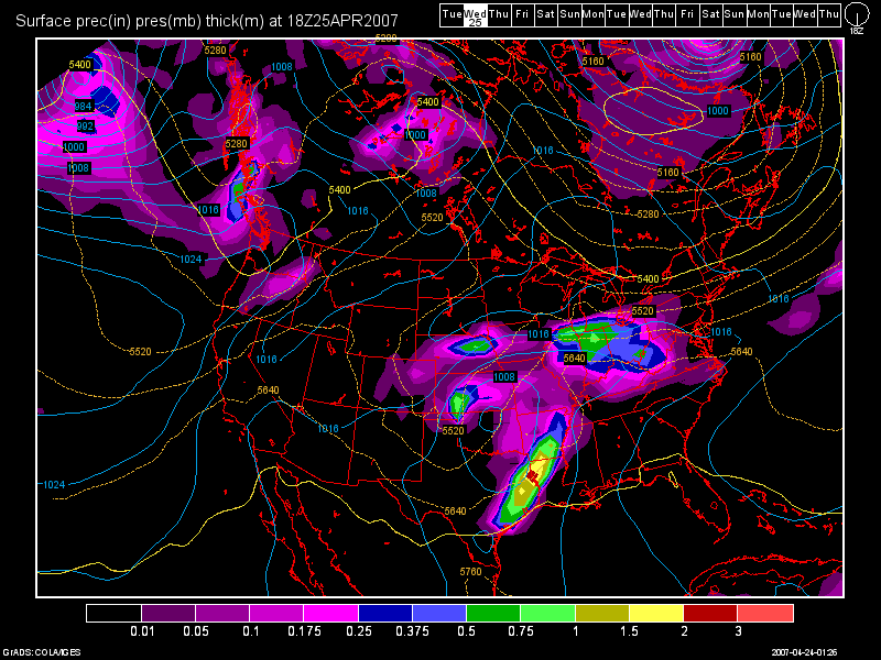
Here is a model image from the 0Z GFS run valid at 42 hours: (Wed. 2pm)

As one can see, the warm front should be North of Cincinnati by then with the heavier rain affecting areas along and North of I-70. On Thurs., we should see another round of rainfall with the cold frontal passage coming in Thurs. night/early Fri. morning. Highs Wed - Thurs will be in the 60s due to the expected cloud cover and rainfall.
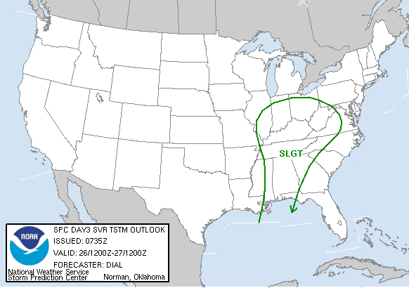
The SPC has us in a slight risk for severe wx on Thurs. We'll have to see how the dynamics look with this system when the front gets closer. I do not think we'll see a widespread severe wx event, as the front should lose some of its punch due to it slamming up against the strong SE Ridge.

This weekend, at this point, looks to be dry, with highs on Sat. close to 70 and in the 70s on Sun.
As we start off a new work week, another cold front could affect the area by Tues. afternoon. Highs on Mon and Tues should remain in the mid 70s.
Long Term Outlook: (May 2nd - 12th)
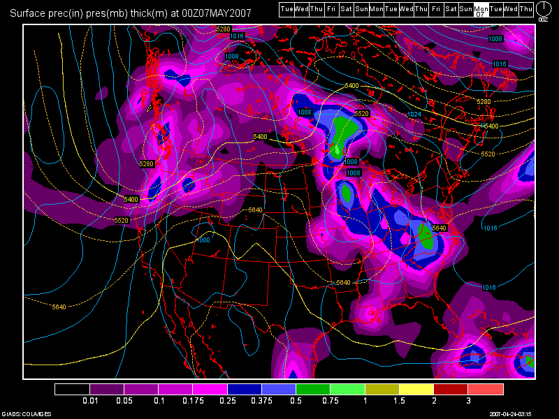
Overall, we can expect above normal temps. to continue with a somewhat unsettled weather pattern continuing. During the long term period, one storm in particular looks pretty decent this far out on the 0Z GFS run. You'll see an image below, which is valid at 312 hours. (May 6th 8pm)


No comments:
Post a Comment