Good evening folks!
I am updating the blog tonight due to our severe wx threat for tomorrow. But, before I get to that, I'd like to first off, start by telling everyone that I am now on high speed Internet access here at the Burlington Weather Office!!! I'd like to thank my family for making that possible! In addition to that, another upgrade also took place. I am now running GR Level 3 Radar too! This radar allows me to look at a T-storm's attributes, such as hail size, rotation, clouds tops, etc. I'd like to thank Anthony, Jerry, Nick, and Trevor for that!
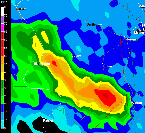
Below, I have posted a GR Level 3 image of a weak T-shower that moved into Boone Co., KY last night around 10pm.

Now... on to tomorrow's severe wx threat.
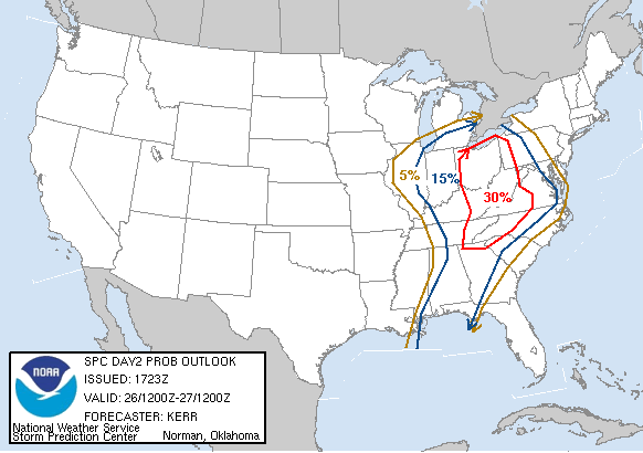
First off, here's the latest severe weather probability map from the SPC:

As one can see, the best chance looks to be along and to the East of the I-71/I-75 corridor. I agree with this map for many reasons:
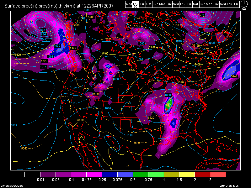
1) If the 12Z GFS Model solution verifies, it shows the surface low pressure area tracking off to our NW. It also, shows some morning convection moving thru which should help to destabilize the atmosphere. I have posted the model image below for Thurs. morning at 8am.

2) Surface Based CAPES are only going to be between 1000-1500 j/kg. That is an ok amount of instability, but I'd rather see values over 2000.
3) The Lifted Index, currently anyways, is only at -2 for Cincinnati. That tells us that we do have a little bit of lift going on in the atmosphere, but I'd rather see values even lower, such as -4, -5, -6, etc.
4) The shear values do actually look good. That is forecast to be between 30-40 knots. That's not bad at all for wind shear in my opinion, so we do have that going for us.
In short, it'll depend on if the morning rains move thru here, and how long it lasts. Also, will it remain cloudy, or will the skies clear out fast enough for the sun to destabilize the atmosphere again? Based on the above images, and above model data that I have shown you, I agree with the SPC and right now, we all stand a shot at seeing severe wx tomorrow afternoon and evening. BUT... the greatest threat area to me will be SE and E OH, WVA, and NW PA. This includes cities such as Columbus, Huntington, and Pittsburgh.
After this storm moves out, we may see a leftover shower Fri. morning, but otherwise the weekend thru Tues. of next week is looking beautiful! I see dry skies and highs in the 70s, warming POSSIBLY into the lower 80s next week!
I'll talk about that in my next blog entry. This one was mainly designed to talk about the severe wx threat for tomorrow.

No comments:
Post a Comment