Hello once again everyone!
I hope everyone is having a nice weekend, although the weather once again has been terrible, with cold and clammy conditions. I lost power here at the Oregonia, OH, branch last night from 4 pm until 3:20 am! So, that's why the blog is being updated today.
Boy oh boy! We have a winter like weather map to talk about today! The NE States are expected to get up to a foot of snow in the interior areas over the next 2-3 days as a monster coastal low stalls out today thru Tues. of the upcoming week. Mountainous areas of the region could get totals exceeding 18" in the highest elevations! WOW!
What does that mean for the OH Valley though? It means NW Flow! Let me explain... the pressure gradient in the upper atmosphere is such that the monster coastal low to our East and at the same time, we have a big blocking high in the NW Atlantic Ocean, near Greenland, which is causing the storm not to be able to push out to sea very quickly. To our West, we have another ridge of high pressure pushing South out of Canada and it's taking up residence in the Plains. This type of jet stream configuration is known as an Omega Block, because it is shaped like the Greek Letter, Omega. This is where you have a trough in the west, a ridge in the plains, and another trough in the Eastern US, then a blocking ridge in the NW Atlantic. This type of weather pattern is slow to breakdown.
So, with that in mind, here in Cincy, we will be dominated in NW Flow. This will keeps temps. below normal, and chances at light precip. from time to time. As we begin the new work week, Mon and Tues. I am keeping dry at this time. A system will try and come into the region Mon,. night, but it's going to be moisture starved. The POP's are so low right now on the GFS, at 16%, that I am leaving the forecast dry until Wed. Highs for Mon should be in the lower 50s and for Tues the upper 50s. I am undercutting the GFS MOS guidance between 2-4 degrees for this forecast period.
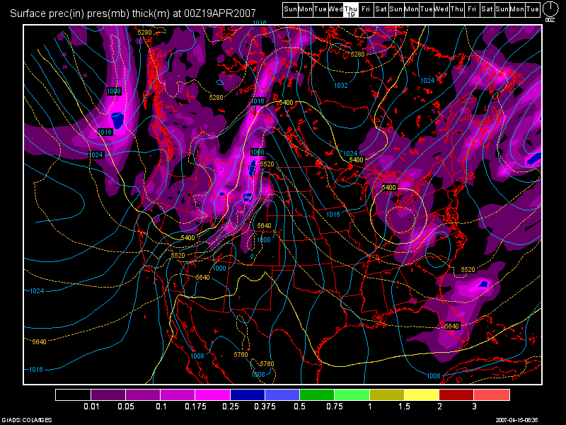
Below, you'll see an image of our next system, which again is somewhat weak, but it does show a decent cold pocket aloft with it. A clipper-type low will dive SE out of Canada and move into the region by Wed. night and move out by Thurs. morning. GFS is too warm. I think North of I-70 a few snow showers mixing in could be possible, while everyone else sees scattered showers. This image is from the 6Z GFS run valid at 90 hours out for Wed. April 19th around 8pm.

Highs on Wed. should top out in the upper 40s, and mid 50s by Thurs. I see a NICE Weekend finally for the Tri-state! Fri thru next weekend right now looks BEAUTIFUL as highs could crack 70 by Sunday!
Long Range Outlook: (April 23rd thru May 1st)
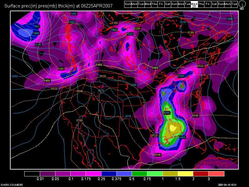
Models bring in our next slow moving, heavy rain making system into the region from April 24th thru possibly the 27th! Below is another 6Z GFS Model image valid at 240 hours for April 25th.

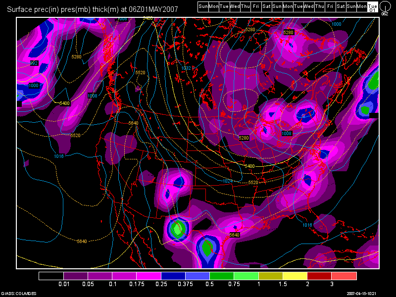
Then, after this system moves out, we have another one due in at the end of the month. Here's one final 6Z GFS image valid at 384 hours for May 1st. Look at how far South the 540 line is! All the way down to us!

As you have seen, this weather pattern shows no signs on breaking down at all. My prediction from the beginning of this month I believe are going to come true. No 80 degree readings at CVG until May! I made that prediction on 9th!

10 comments:
Wohoo! Awesome as always! I really don't think we will break 80° either! I'm loving the cold weather. It's our payback for the weather we didn't get in NOV, DEC, JAN. Again, another awesome post!
Thanks again Nick for tose kind words! You've always been a big supporter of my work. Your passion and energy for the weather will only make you a success later in life!
Speaking of 80s... we may need to expand the streak of non-80 dregree weather until early or mid-May as this pattern shows no signs of going anywhere, anytime soon.
I agree, unless old man winter gets his viagra going, then he's gonna be here for awhile!
ROFL! I thought that was only Rush Limbaugh!
Well, him, old man winter, and Hugh Hefner.
Those Play-boy Bunnies are all the viagra he needs LOL!
Oh ain't that the truf! He is one luck SOB!
Yeah boy!
I like coldness and all but I dont mind some sun right now it is April so we should have April weather..lol its all confused
Yes Martie, I agree. You're absolutely right! We'll have some warmer weather this week. Expect 70 or better this weekend!
Post a Comment