Well, ok... I busted on the severe wx event that we had yesterday. The T-storms were marginally severe with pea sized hail being most common in the reports that I read. Hail covered the ground in a lot of areas as well. For my particular county, Boone Co. in Northern KY, I saw none of this action. I did not bust for my county at least. The storms weakened as they moved through my area, then re-intensified as they moved to my North and East. I must have an "Anti Severe Wx Deflector Shield" up over my house or something.
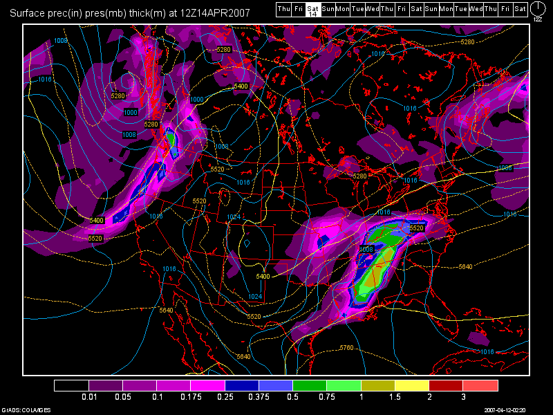
The models have been trending much, much colder with our next precip. event for this weekend. The models are now in agreement in tracking a surface low pressure system through the TN Valley. This will result in a zero threat for T-storms and more of an E to NE flow with a steady rain. I also think that the precip. could start out as some wet snow briefly before turning over to all rain during the day on Sat. The further NE of Cincinnati that you are, the better chance you'll have at getting snow, versus areas to the SW. The 12Z NAM shows mainly snow on Sat. north of the OH River. That is a bogus model run! The 6Z NAM is in much better agreement with the GFS and the rest of the models. I checked the 0Z GFS model run and it too is in good agreement with the placement of the surface low track.
Here is an image of the 0Z GFS valid at 60 hours, which is 8am Sat. morning:

High temps. on Sat. should be in the lower to middle 40s. For Sunday, we'll continue to see the 40s for high temps. as well with some morning snow showers and afternoon rain showers. The coverage will be spotty though, and I do not see any travel problems for the Cincinnati Tri-state.
As we begin a new work week, FINALLY, some nicer weather will return to the region. After the low moves through the TN Valley this weekend, it will deepen and stall out off of the New England Coast. This will result in a drier weather pattern for us Mon - Wed. of next week with highs in the upper 50s for Mon. warming into the lower to middle 60s for Tues. and Wed. I think for Wed. we'll see increasing clouds in the afternoon ahead of our next storm system.
Long Range Outlook: (April 19th - 28th)
I still see a relatively weak system for Thurs., the 19th. The 0Z GFS is not spitting out much precip. here at this point. After that, another system could affect our region around the 23rd, but at this point, most of the energy looks to be centered over the Great Lakes.
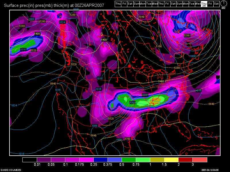
As we come to the end of the long range period, as I stated in my last blog entry, a slow moving heavy rain maker still looks to be in the cards for April 26-28th. I have included another 0Z GFS model run valid at 336 hours.


No comments:
Post a Comment