Friday, May 25, 2007

VERY Isolated Rain Chances - GFS Says Trough for the 1st Week of June, While Euro Says Nope!

05/25/07 6:10am

I know that I have not updated the blog here in a long time, but we really have not had anything to talk about here in the Ohio Valley. Also, since I'll be on vacation, I wanted to get this entry in. Blog Updates will resume on or after June 5th.

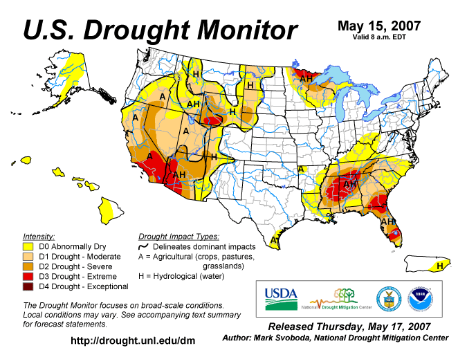
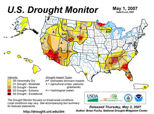
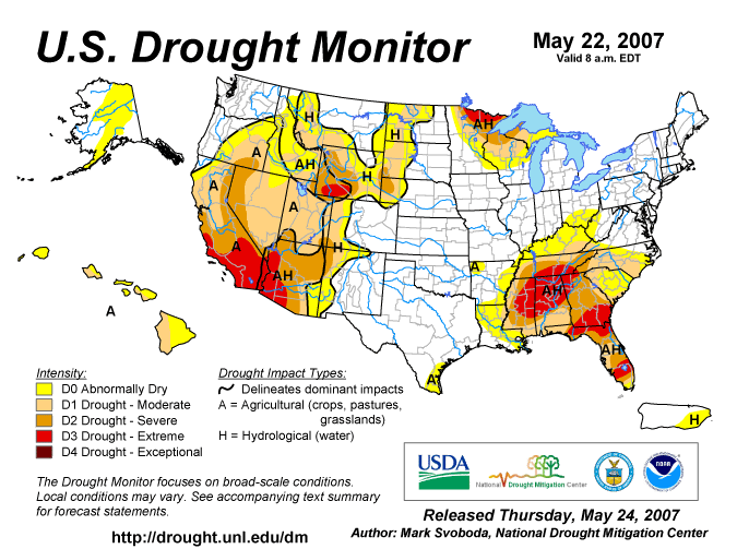
In the meantime, the drought continues to worsen across the Eastern US. The latest US Drought Monitor Map is posted below. Notice how the D1 area has moved into SE KY. Also, notice how the SE US is in desperate need of some rainfall. Folks... it's just NOT going to happen! Well, at least for the SE US anyways, unless some tropical activity gets going later on down the road.

Photo Sharing and Video Hosting at Photobucket

For us here at home, a cold front continues to weaken and slow its forward progress. The Ridge that has been dominating the Eastern US will continue to do so. Therefore, I expect the front to NOT even make it this far South whatsoever until maybe Sun. night or on Memorial Day. I think today, most everyone will remain dry. The best chance to see any rain is going to be North of I-70. Highs should be in the mid to perhaps the upper 80s for today.

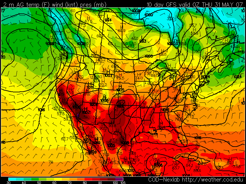
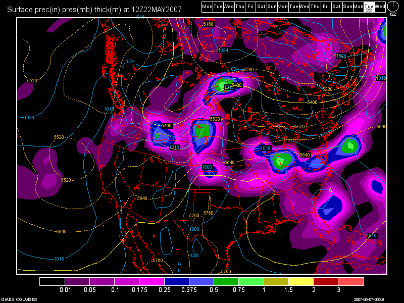
For the Holiday Weekend, on Sat., the front lifts back North as a warm front. I can not rule out an isolated storm, but 95% of the region will remain dry and see nothing. Highs again will be in the lower to middle 80s. On Sun., I think we do stand a better chance as the front comes South again. This time, we may actually get some better upper level support, so I am expecting probably about 30% coverage this time! Highs again, will be in the lower 80s. For Memorial Day, I expect a continued chance of storms with again, about 30% coverage, and highs again should be in the lower 80s.

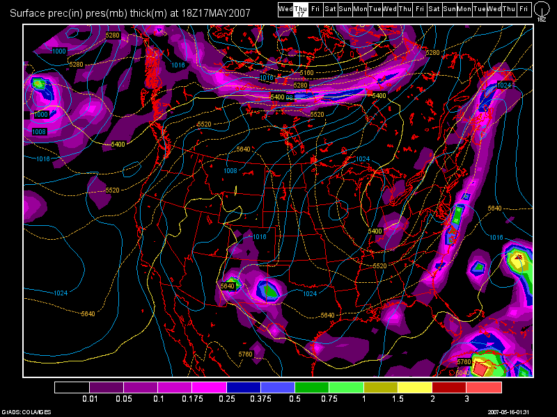
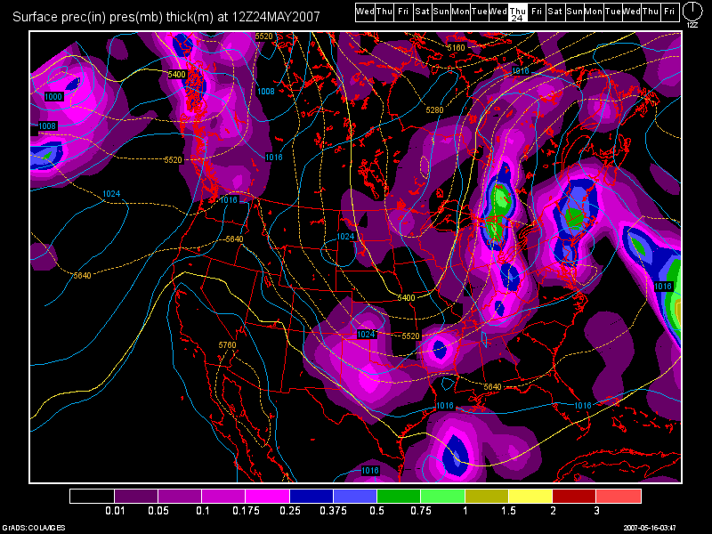
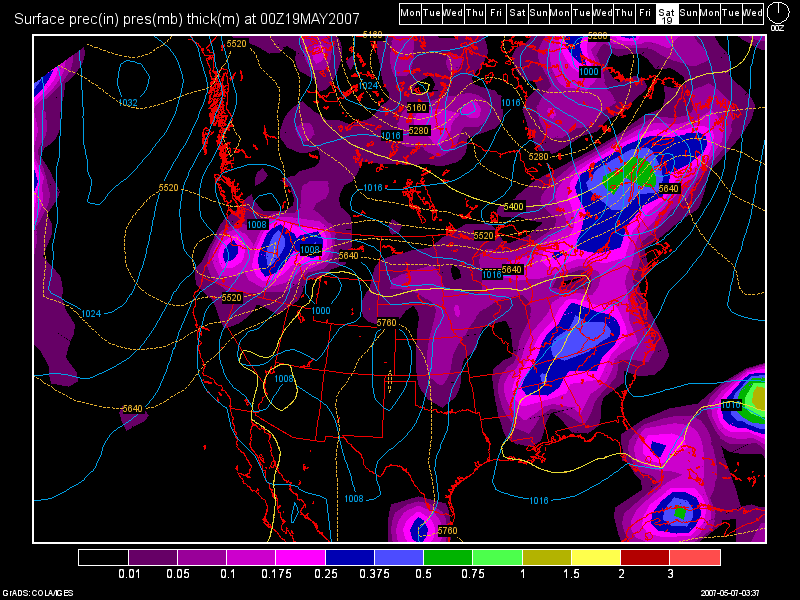
At this time, I expect Tues to be dry. Another front will try and move in by midweek, so again, about a 30% chance at seeing a storm on Wed. and Thurs. with highs in the lower 80s for Wed. dropping to the upper 70s to perhaps 80 by Thurs. As you can see by reading this blog entry thus far, no widespread rains are expected. These are going to be your garden variety storms. If you get one in your backyard, consider yourself fortunate. Also, this will do NOTHING to help us out in drought dept. The rainfall from these type of storms comes quickly and doesn't last all that long, and with us having such dry ground now, the water will not soak in, but rather just run right off.

Long Term Outlook (June 1-10th) :

The models have been performing horribly as of late. They can not handle this type of weather pattern at all. The GFS is trying to develop a HUGE Trough over the Eastern US for the 1st week of June. I disagree with this model solution. The Ridge that we currently have in place will not give up the fight that easily. The GFS also has a bias of trying to change weather patterns too quickly. I've been watching this potential pattern develop over the last week or so. Some model runs, the GFS keeps the Ridge in place, and then sometimes it develops the Trough again. It has not been consistent at all lately. The Euro model, however, has been VERY
consistent. It never has shown a trough developing, and it keeps the Ridge over the Eastern US intact.

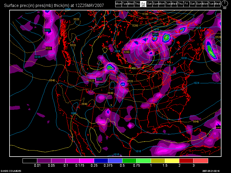
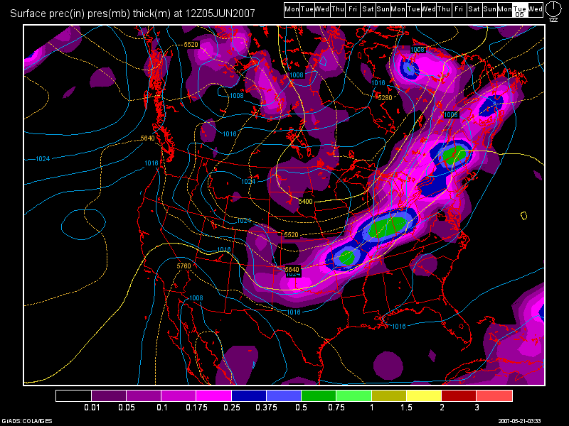
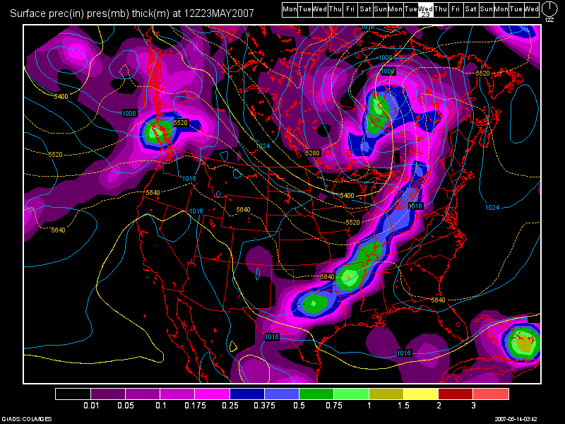
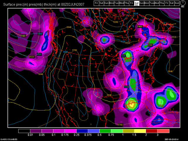
I have some more images to show you. The first one is the 0Z run of the GFS valid at 192 hours, which is June 1st at 8pm. Since the GFS is trying to develop the trough over us, check out this nice cold front that it shows plowing through the region.

Photo Sharing and Video Hosting at Photobucket

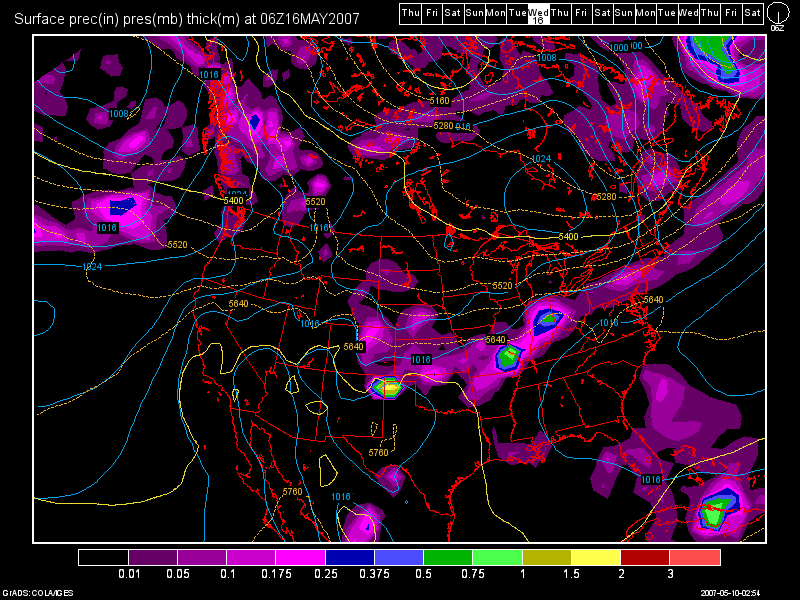
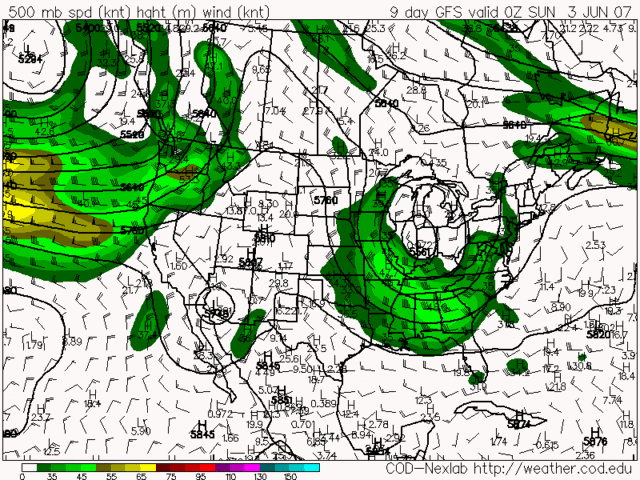
Again, as I stated above, this model run is total garbage! I will show you why. Look at the next 2 model images. The first one will be the 0Z GFS run for Sunday, June 3rd. This is not the usual precip. map that I keep showing. This map shows the upper level winds at 500MB. It almost looks like a jet stream type of map. Notice the U-shaped configuration over the OH Valley. That is the Trough that it is trying to develop.

Photo Sharing and Video Hosting at Photobucket

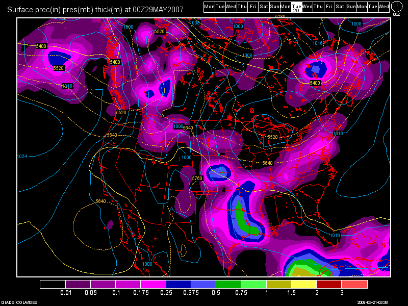
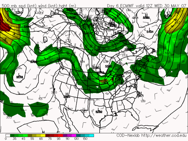
The next image is the same kind of map, but it's the Euro model (ECMWF). Notice how the ridge stays in place, and the Trough remains to our NW over Canada, the Northern Plains, and maybe into the Great Lakes. This map is valid at 144 hours, or May 30th. Looking even further ahead, the Euro still maintains the Ridge over the Eastern US into the 1st week of June.

Photo Sharing and Video Hosting at Photobucket

I am definitely going with the Euro model for my long range forecast. It has been a VERY consistent model ever since we have been in this dry and mild weather pattern. Sure, there will be chances of isolated storms from time to time, such as what I talked about at the beginning of this blog. But, as far as drought busting, soil moistening, widespread rains, I just do not see that happening.

Have a GREAT Memorial Day Weekend everyone! Be safe, have fun, but most importantly, Support our TROOPS! They sacrifice a lot for our safety. If you know someone who is a Veteran, thank them as well!

Monday, May 21, 2007

Drought Continues to Worsen - Front to Approach by Friday

5/21/07 6:20am

The drought continues to worsen over the Midwest, Ohio Valley and SE US. The US Drought Monitor Map was updated this past Thursday. Notice how the D0 area has expanded to encompass KY now, and areas to the S and E of Cincinnati are also impacted.

Photo Sharing and Video Hosting at Photobucket

The next map that I would like to show you, are the precip. departures over the Nation for the last 3 months. Notice here how badly the SE US needs rain! Unfortunately, this weather pattern is not going anywhere anytime soon. I expect conditions to get much worse, before they get better. I'll have more on the drought later.

Photo Sharing and Video Hosting at Photobucket

Is there any relief in site? No... not really. The strong SE ridge will continue to dominate our weather picture this week. I expect dry conditions and highs in the 80s today thru Thurs. Our next cold front will begin to affect the region on Friday. Unfortunately, the front will weaken as it approaches thanks to the strong SE Ridge. I think the 0Z GFS model run shows that nicely. Below is the 0Z Run valid at 108 hours, Friday morning at 8am.

Photo Sharing and Video Hosting at Photobucket

The front will then stall in our area for the weekend. Earlier models were showing a wave of low pressure riding along the front for Sat., thus continuing our rain chances for the upcoming weekend. However the 0Z Run shows the front by Sunday moving back North as a warm front and kind of wavering back and forth over the Ohio Valley for next week. However, to me, the majority of the energy looks to stay to the North and West of us.

Long Range Outlook: (May 27th thru June 5th)

As stated above, the front will continue to be the focus for Showers and Storms. However, where exactly does the front stall out remains key. I still think that due to the SE Ridge, the front will largely bring precip. to our North and West because that's where the trough will be centered. The Ridge will continue to keep any widespread rainfall chances at bay. Below, is the 0Z GFS run valid at 192 hours, Monday 8pm. Look as the front tries to make some Southward progress again. See how it is weak once again.

Photo Sharing and Video Hosting at Photobucket

The next image is valid at 372 Hours, Tues June 5th at 8am. Another stronger cold front will try and push thru then. Being how far out in time this model is, forecast confidence will remain low. I won't be a bit surprised as time goes by, that the GFS will weaken it as well.

Photo Sharing and Video Hosting at Photobucket

Finally, one more point to bring up on the drought situation... The American Models (GFS, NAM) last week where actually trying to show a trough developing in the Eastern US for the last week of May, and folks, that is NOT going to happen. The Euro Model is correct, keeping the ridge here and a trough out to the West. Over the weekend and continuing into the today, the American Models have jumped ship and now are in agreement with the Euro. All models now are showing a BIG RIDGE developing in the next 2 weeks with little chances at getting any decent rainfall. Highs could easily reach into the 90s as well. The last image that I wanted to show everyone, is the 0Z GFS surface temps. valid on May the 31st. Look at the heat building.

Photo Sharing and Video Hosting at Photobucket

Wednesday, May 16, 2007

Rain Ends This Morning - Chance of Showers on Thurs then Dry Until May 24th-25th

5/16/07 6:15am

Well, as expected, the severe weather reports were isolated in nature. Dearborn Co. in SE Indy had some 3/4" hail reported and also some trees knocked down. A few other reports were noted in the Tri-State as well, but they were isolated in nature. Most of us saw heavy rain, and wind gusts to 40 or 50mph which is below the 58mph severe t-storm criteria. The overnight rains are still ongoing as I write this blog. However, in the next hour or two most of it will be gone. Below, is a radar image as of 6am:

Photo Sharing and Video Hosting at Photobucket

After the cold front passes thru early this morning, we can expect partly to mostly cloudy skies and highs in the middle 60s today. Tonight and tomorrow, another weak piece of energy will rotate through the Tri-State from the NW. It will drop SE across the region during the day on Thurs. This upper level disturbance should have enough instability associated with it, to touch off a few showers and maybe even an isolated T-storm as well.

Below, I present to you the 6Z NAM run for tomorrow, valid at 33 hours, followed by the 0Z GFS run for tomorrow valid at 42 hours. Note, how the NAM is again overdoing the amount of precip. It did the same thing in regards to the system that's pulling out now as we speak. The NAM was going for over an inch of rain, while the GFS was right on the money with .25-50"! I will side with the GFS for tomorrow's forecast as well, and I think most everyone will not see very much rain at all. I think a tenth on an inch or less as the GFS suggests should cover it.

6Z NAM:

Photo Sharing and Video Hosting at Photobucket

0Z GFS:

Photo Sharing and Video Hosting at Photobucket

Highs on Thurs. will also be in the mid to upper 60s. By Friday, sunshine will return along with a slow moderating trend. Highs on Friday should be close to 70 and for the weekend, I expect dry skies and highs in the lower to middle 70s.

As we start a new workweek, clear skies continue for both Mon and Tues, and highs in the upper 70s both days, maybe cracking 80 by Tues. can be expected as another Canadian High dominates our weather picture.

Long Range Outlook (May 23rd - May 31st)

Again, there is little to talk about during the long range assessment period. The models still show nothing going on until the end of next week. During the May 24-25th time frame is when our next good threat of rain will be. So, whatever rains we received from today's system and tomorrow, will quickly dry out and be a memory. I have posted the 0Z GFS run valid at 204 hours, and even here, the system does not look as impressive as it once did.

Photo Sharing and Video Hosting at Photobucket

After this system, another dry spell which should last until the end of the month. The GFS is still hinting though at another system by the 31st, which is what I mentioned to you as well in my last blog entry. That system still looks weak however.

Monday, May 14, 2007

Two Storm Systems for the Rest of May - Drought Continues to Develop

5/14/07 6am

Well folks... the drought continues to develop over the Eastern US. Wildfires are burning in FL and GA and also add the Upper Midwest (MN and WI) to the list. We only have two systems to discuss at this point. The first system should be coming in Tues. night / early Wed. morning. The models have been consistent with bringing the front in late Tues. night. The best window of opportunity for us looks to be after midnight Tues. night thru the first half of the day on Wed. I have posted the 0Z GFS model run image below, valid at 54 hours (2am Wed. morning).

Photo Sharing and Video Hosting at Photobucket

I think between 0.25" and 0.50" of rainfall is possible with this system. Unfortunately, this will do little, if anything, to ease the developing drought. The reason: We have no other storm systems coming in until the May 23rd-24th time frame. Our current weather pattern shows no signs of changing. I'll have more on the 2nd system a bit later.

As far as the severe wx aspects go with our next system, checking the latest RUC model run (0Z), it shows some moderate instability in the region ahead of the cold front. Surface Based CAPES should be approaching the 1500 j/kg mark with a Lifted Index of -4. These two values show that we have some decent instability and lift present in the atmosphere. However, the shear values are weak. Upper level shear looks to only be around 10 knots and lower level being less then 5 knots. This will be working against severe wx development. Precipitable Water values will be approaching 1", so a few heavier down pours are not out of the question. I think the chances are slim, but I can not rule out an isolated severe storm or two Tues. night. The SPC seems to agree and here is their Day 2 Outlook below:

Photo Sharing and Video Hosting at Photobucket

As far as temps. go, we'll see the lower 80s today, and the middle 80s for tomorrow. By Wed., the front will be moving thru in the morning hours, so temps. will be held in check and will be in the upper 60s for highs.

After that storm system, I see nothing happening for the remainder of the medium range forecast period. We can expect a moderating trend during the Thurs. thru Sun. period this week with highs in the upper 60s to near 70 for Thurs. and in the lower to mid 70s for the remainder of the period. Skies will be mostly clear during this time period.

Long Range Outlook (May 20th - 29th) :

Again, as I've stated before, after our Tues. night/Wed. morning system, there is nothing going on at all until May 23rd-24th. This is the 2nd system that I mentioned at the beginning of the blog. This weather pattern just keeps repeating itself. Canadian High Pressure keeps dropping into the region behind each storm system that moves thru. The Pacific NW, continues to be under a trough, and that is causing a ridge to form over the Rockies and Plains States, plus the fact that the SE ridge continues to hold tough as well. Below, you'll find the 0Z GFS model run image valid at 228 hours (8am Wed. May 23rd) :

Photo Sharing and Video Hosting at Photobucket

After that system, there is not much to talk about for the rest of the month. the 0Z GFS is hinting at possibly another system by month's end, but we'll see if that system still shows up when I do my next blog entry. Temps. during the long range period should start off in the upper 70s warming into the 80s ahead of the 23rd-24th storm system then back down into the 70s once again after it moves thru.

One final note that I'd like to discuss, is the developing drought. In my last blog entry, I talked about the developing drought briefly and I also posted the US Drought Monitor Map. Scroll down to see the US Drought Monitor Map in the previous blog entry. For this blog entry, I'd like to talk about the developing La Nina as well, which is also factoring into all of this. I'd like to post an animated image below of the Sea Surface Temps. (SST's) values off of the South American Coast. Notice the blue area expanding. We now have a weak La Nina in place.

Photo Sharing and Video Hosting at Photobucket

If the La Nina strengthens further, which it is forecast to do so, then I think that this weather pattern we are in may not change. The good news is hopefully we can get some beneficial rains from any tropical systems that develop, as our rains during the summertime primarily come from T-storm development which is usually isolated to scattered in nature. I still expect above normal tropical activity in the Atlantic Basin this year.

Thursday, May 10, 2007

From Subtropical Storm Andrea to a Potential Developing Drought

5/10/07 6am

Good morning everyone!

We have little to discuss in our weather in terms of rainfall or severe wx, so this blog will be discussing what's going on around us, and the long term implications that could be in our future.

Subtropical Storm Andrea is the first named storm of the 2007 Atlantic Hurricane Season. This system is a hybrid of sorts because it is not a warm core system as most tropical systems are, and it's not a mid-latitude cyclone, which are the kind of storms that we see here in the OH Valley. Therefore, it's called a Subtropical storm. Winds are still around 45 mph and the system is still spinning and slowly drifting to the W and SW off of the SE Coast. The models are forecasting the system to keep slowly drifting eventually more to the SW over the next few days. It's going to be a while before it's totally gone. Not much rain is falling in the fire ravaged areas of Georgia and Florida. It's actually creating more of a problem due to the strong E to NE winds on the Western side of the storm. These winds are dry winds and they are fanning the flames and making for awful conditions for fire fighters.

This system actually does affect our weather in a more indirect sort of way. We are sandwiched in between Andrea and a system out in the Plains. As has been the case for the last couple of weeks, the cold fronts weaken, if not totally die out, by the time they move into the OH Valley. This is caused by the strong ridge of high pressure that continues to dominate the Eastern US. Look at this morning's Satellite Imagery, and you'll see what I mean. There is a major lack of cloud cover over most of the Nation.

Photo Sharing and Video Hosting at Photobucket

In regards to our rain chances that I talked about in my last blog entry, those chances are diminishing with every future GFS model run. In fact, we stand about a 10 to maybe 20% chance of seeing a spotty shower or T-storm for this afternoon and early Friday morning. Most areas will remain dry. Highs will continue to be above normal, in the lower to middle 80s. Normal highs for this time of year should be around 72 or 73 degrees.

Another strong high pressure ridge will drop down from the Great Lakes and dominate our weather thru early Tuesday. Highs this weekend will be in the middle 70s under sunny skies! We'll see low humidity values as well. Even though we need the rain badly around here, you couldn't have asked for better weather for Mother's Day! On Monday of next week, highs will moderate back into the 80s once again.

By Tues. of next week, this is the best chance of rain that I can find for the next 10 days or so. Remember my last blog entry, where the 3rd week of May was looking stormy? Not anymore folks. As stated above, the GFS runs show strong systems 7-10 days in advance then after a few days, the models weaken the cold fronts considerably. That model trend will continue as long as the ridge continues to dominate our weather, which I believe it will. It looks like our best chance will come Tues. afternoon and into the overnight period. Even then, I'd only say 50% coverage at this point. The GFS may even continue to weaken this system further. I'll continue to monitor. But for now, here's a look at the 0Z GFS model run valid at 150 hours (Tues night/Wed. morning at 2am) :

Photo Sharing and Video Hosting at Photobucket


Long Term Outlook (May 15th - 25th)

After that system moves out, there is NOTHING, and I mean NOTHING to really talk about. I continue to see above normal temps. and a ridge of high pressure continuing to dominate our weather pattern. The next system I could find is scheduled for the May 23-24th time frame. We all know that the GFS will probably even weaken this system too in time. But, here is the 0Z GFS model run image valid at 348 hours (Thurs. May 24th at 8am) :

Photo Sharing and Video Hosting at Photobucket

Is there a potential drought developing?

The simple answer to that is, YES! I think that the chances for a drought are increasing rapidly with each passing day. We have had only .14" at CVG for the month of May and .10" at Dayton. The month of May is our wettest month of the year at over 5" for CVG. We will come no where near that! We are running behind in the rainfall dept. as one can clearly see. If we do not receive any widespread rains in the next couple of weeks, then be prepared for a drought, and a long, hot summer. You heard it here folks! That is my prediction at this time. I see no shift in this weather pattern at all. The ridge will continue to dominate the Eastern US. In fact, the Upper Midwest, Great Lakes, Ohio Valley, SE US, and New England are all running below normal in the rainfall dept. Numerous fires continue to burn in Florida and Georgia.

Below, I have posted the Drought Monitoring Map from the Climate Prediction Center. (CPC) This image was last updated on May 1st. As long as we remain in this weather pattern, I'll continue to post the map on the blog here from time to time.

Photo Sharing and Video Hosting at Photobucket

Notice that currently, we're fine. We have not been classified as a drought area yet. But in another couple of weeks, if things do not change, then we probably will be. Notice that Southern KY is in the D0 status now. I again, do not see us getting any huge amounts of rainfall in the next few weeks.

Monday, May 7, 2007

Weather Pattern May Repeat Itself this Week

05/07/07 5:55pm

Good morning everyone!

I apologize in advance for not posting a blog entry sooner. I celebrated my Birthday over the weekend, and was also out of town fishing a walleye tournament on Lake Erie as well. Unfortunately, due to strong Easterly Winds, the tournament was cancelled. But, it's been rescheduled for June the 16th.

As far as the weather goes, a ridge should dominate our weather here in the OH Valley for the first half of the week, while the Plains States and Texas in particular, continue to get pounded by Severe WX. We have a blocky type of weather pattern in place at this time with continued troughs of low pressure coming into the Western US, which continue to spark off Severe WX out to our West. Meanwhile, we have a ridge of high pressure over the Eastern US, and another deep ocean low off the East Coast.

To better illustrate this, I have posted a surface map below:

Photo Sharing and Video Hosting at Photobucket

For temps. this week, I expect the 70s today, close to 80 tomorrow, and in the lower 80s for Wed. We can expect clear to partly cloudy skies all 3 days. By Thurs., a weak front tries to push into the region suppressing the ridge to the South. The fronts impact looks to be weak at this time. The 0Z GFS at 90 hours (2pm Thurs.) shows this quite well.

Photo Sharing and Video Hosting at Photobucket

The 0Z NAM shows the area not receiving anything at all! I will side with the GFS at this time, and wait for future model runs to see if this weakening trend continues. The front will be slow to move through and should be off to our South on Friday. I've also been toying with the idea that this front could stall and bring us rain through the weekend as well, but the 0Z model runs do not show this idea like the 12Z runs did yesterday. If the 0Z run verifies, we'll have a nice weekend on tap. My confidence in the forecast is low after Day 5, so rain chances may need to be inserted past Friday if the front does indeed stall. I'll continue to monitor. For temps. upper 70s to the lower 80s look good at this point due to low forecast confidence.

Long Term Outlook (May 14th - 23rd)

The models continue the domination of the ridge as a new ridge forms during the middle of the month and more troughiness affects areas to our West. A stormier pattern looks possible though during the 3rd week of the month. A stalled out front to our South looks to return North as a warm front and bring rain and storms to our area May 18-20th. Here is another 0Z GFS model run image valid at 288 hours (Fri. May 18th, 8pm) :

Photo Sharing and Video Hosting at Photobucket

Then, the flow backs to the SW again in response to more surface low development out in the plains towards the end of the long term period. The front will finally try and push through, but due to the SE ridge, it'll have a hard time doing so. I have one final 0Z GFS image to show you. This one is valid at 372 hours (Tues. May 22nd, 8am) :

Photo Sharing and Video Hosting at Photobucket

Wednesday, May 2, 2007

Cold Front to Stall - Rain for Wed. Night thru Thurs. Night

5/2/07 5:55am

Good morning everyone!

It looks like my downplaying of the severe wx threat for Cincinnati worked out perfectly! The front did indeed slow down as forecast by the models yesterday morning. All of the action was up in Northern Indiana and NW Ohio. There was one tornado report, and a ton of large hail reports as well. Below, is a GR Level 3 Radar Image taken around 6:20pm last night. Look at all of the T-storms and all of the warnings that were in effect for the area! The red boxes are the counties under Severe T-storm warnings, and the purple boxes are tornado warnings.

Photo Sharing and Video Hosting at Photobucket

That same cold front, still has not made it South to the OH River as of yet. The models were off by 30 or 40 miles! I checked surface observations this morning, and at Dayton, they had North winds, so we know the front is past that area, and at CVG, the winds were still out of the West. So, the front lies in between here and Dayton. Check out the Satellite imagery below, and you should be able to pick out where the front lies in accordance with the band of clouds associated with it. No rainfall is being generated though at this time.

Photo Sharing and Video Hosting at Photobucket

The front is still to forecast to drop a tad further South and stall along the OH River by this evening. As a result, showers and storms are likely overnight tonight and again on Thursday. The next 2 images are of the latest GFS Model run. The first image is valid at 42 hours (Early Thurs. morning at 2am) and the other for 48 hours (Thurs. morning at 8am).

Tonight at 2am

Photo Sharing and Video Hosting at Photobucket

Thurs. Morning at 8am

Photo Sharing and Video Hosting at Photobucket

My forecast confidence in this model solution is not of the highest confidence. The SE Ridge is still VERY strong. The models have been way off in regards to the position of this front. They keep wanting to bring it South and it's just not happening. I would not be a bit surprised if the moderate to heavy rain area shifts a little bit further North then currently forecast. It's going to depend on how strong the big High pushing down from the Great Lakes is. There will be a sharp Northward cut-off of the precip. shield during this time period as whomever lies to the North of the front, will be experiencing a dry NE flow. So, the best chance for rainfall over the next 48-60 hours, will be from Cincinnati on South. For those in Brookville, IN to Dayton, OH to Columbus, OH... you folks could be dry and see very little, if any precip. during this time. High temps. for today and Thurs. depend on where the front sets up shop. South of the boundary I except highs in the 70 to 75 degree range and North of the front, temps. should stay in the 60s. Thurs., if we see the rain and clouds as the models suggest, temps. should remain in the 60s for everyone.

After this system moves out, we'll see perhaps some morning rains. followed by decreasing clouds on Fri. with some sunshine by afternoon. Highs again should be in the upper 60s. By the weekend, the front should have slipped far enough South into Central and Southern KY, that the Entire Tri-State should be under clear skies with highs in the mid to upper 70s! Right now, this weekend looks like a beauty!

As we begin a new work week, that large area of High pressure that I mentioned above, will still be in control of our weather. Highs on Mon. and Tues. of next week should be around 80 degrees or so.

Long Range Outlook: (May 9th - May 17th)

Overall, a ridge should still be dominating the region. The long range models show a few weak systems from time to time, but nothing major until the end of the outlook period. We should continue to see above normal temps. during this time. Currently, a couple of weak looking fronts are forecast to affect the region around May 11th, then another around May 14th-15th. Finally, as we hit the end of the long range period, a more decent looking front is forecast to affect the region. Below is another GFS Model image valid at 384 hours (May 17th at 8am)

Photo Sharing and Video Hosting at Photobucket