Good morning everyone!
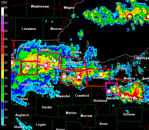
It looks like my downplaying of the severe wx threat for Cincinnati worked out perfectly! The front did indeed slow down as forecast by the models yesterday morning. All of the action was up in Northern Indiana and NW Ohio. There was one tornado report, and a ton of large hail reports as well. Below, is a GR Level 3 Radar Image taken around 6:20pm last night. Look at all of the T-storms and all of the warnings that were in effect for the area! The red boxes are the counties under Severe T-storm warnings, and the purple boxes are tornado warnings.
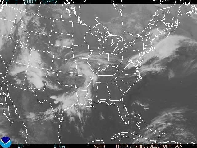
That same cold front, still has not made it South to the OH River as of yet. The models were off by 30 or 40 miles! I checked surface observations this morning, and at Dayton, they had North winds, so we know the front is past that area, and at CVG, the winds were still out of the West. So, the front lies in between here and Dayton. Check out the Satellite imagery below, and you should be able to pick out where the front lies in accordance with the band of clouds associated with it. No rainfall is being generated though at this time.
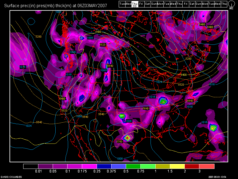
The front is still to forecast to drop a tad further South and stall along the OH River by this evening. As a result, showers and storms are likely overnight tonight and again on Thursday. The next 2 images are of the latest GFS Model run. The first image is valid at 42 hours (Early Thurs. morning at 2am) and the other for 48 hours (Thurs. morning at 8am).
Tonight at 2am
Thurs. Morning at 8am
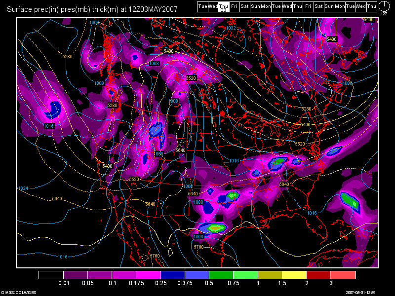
My forecast confidence in this model solution is not of the highest confidence. The SE Ridge is still VERY strong. The models have been way off in regards to the position of this front. They keep wanting to bring it South and it's just not happening. I would not be a bit surprised if the moderate to heavy rain area shifts a little bit further North then currently forecast. It's going to depend on how strong the big High pushing down from the Great Lakes is. There will be a sharp Northward cut-off of the precip. shield during this time period as whomever lies to the North of the front, will be experiencing a dry NE flow. So, the best chance for rainfall over the next 48-60 hours, will be from Cincinnati on South. For those in Brookville, IN to Dayton, OH to Columbus, OH... you folks could be dry and see very little, if any precip. during this time. High temps. for today and Thurs. depend on where the front sets up shop. South of the boundary I except highs in the 70 to 75 degree range and North of the front, temps. should stay in the 60s. Thurs., if we see the rain and clouds as the models suggest, temps. should remain in the 60s for everyone.
After this system moves out, we'll see perhaps some morning rains. followed by decreasing clouds on Fri. with some sunshine by afternoon. Highs again should be in the upper 60s. By the weekend, the front should have slipped far enough South into Central and Southern KY, that the Entire Tri-State should be under clear skies with highs in the mid to upper 70s! Right now, this weekend looks like a beauty!
As we begin a new work week, that large area of High pressure that I mentioned above, will still be in control of our weather. Highs on Mon. and Tues. of next week should be around 80 degrees or so.
Long Range Outlook: (May 9th - May 17th)
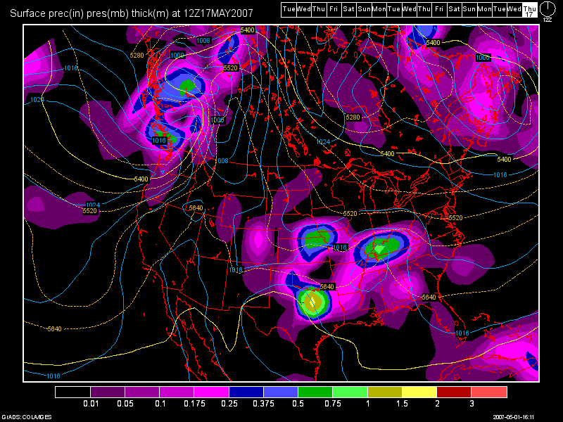
Overall, a ridge should still be dominating the region. The long range models show a few weak systems from time to time, but nothing major until the end of the outlook period. We should continue to see above normal temps. during this time. Currently, a couple of weak looking fronts are forecast to affect the region around May 11th, then another around May 14th-15th. Finally, as we hit the end of the long range period, a more decent looking front is forecast to affect the region. Below is another GFS Model image valid at 384 hours (May 17th at 8am)

No comments:
Post a Comment