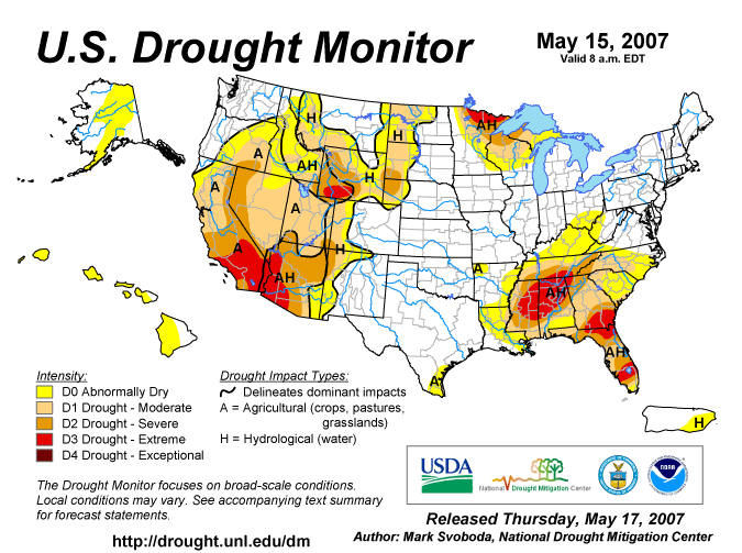
The drought continues to worsen over the Midwest, Ohio Valley and SE US. The US Drought Monitor Map was updated this past Thursday. Notice how the D0 area has expanded to encompass KY now, and areas to the S and E of Cincinnati are also impacted.
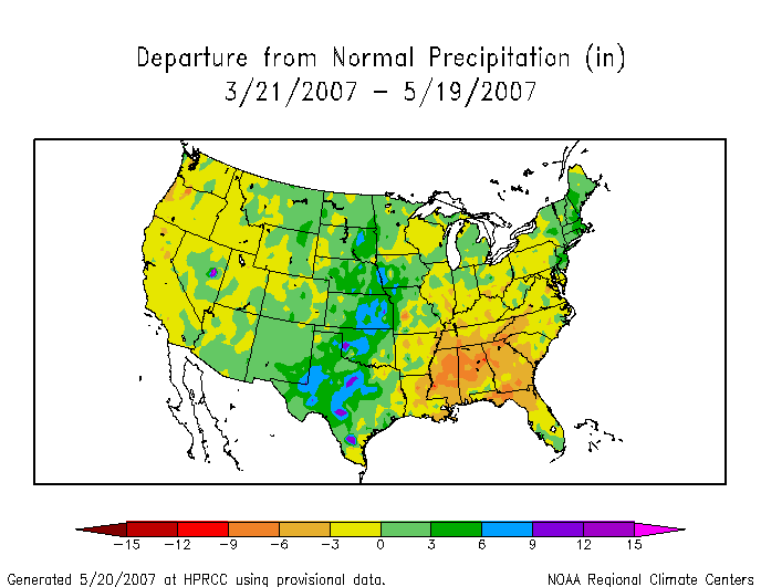
The next map that I would like to show you, are the precip. departures over the Nation for the last 3 months. Notice here how badly the SE US needs rain! Unfortunately, this weather pattern is not going anywhere anytime soon. I expect conditions to get much worse, before they get better. I'll have more on the drought later.
Is there any relief in site? No... not really. The strong SE ridge will continue to dominate our weather picture this week. I expect dry conditions and highs in the 80s today thru Thurs. Our next cold front will begin to affect the region on Friday. Unfortunately, the front will weaken as it approaches thanks to the strong SE Ridge. I think the 0Z GFS model run shows that nicely. Below is the 0Z Run valid at 108 hours, Friday morning at 8am.
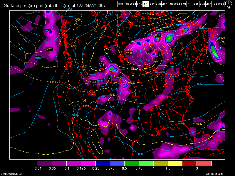
The front will then stall in our area for the weekend. Earlier models were showing a wave of low pressure riding along the front for Sat., thus continuing our rain chances for the upcoming weekend. However the 0Z Run shows the front by Sunday moving back North as a warm front and kind of wavering back and forth over the Ohio Valley for next week. However, to me, the majority of the energy looks to stay to the North and West of us.
Long Range Outlook: (May 27th thru June 5th)
As stated above, the front will continue to be the focus for Showers and Storms. However, where exactly does the front stall out remains key. I still think that due to the SE Ridge, the front will largely bring precip. to our North and West because that's where the trough will be centered. The Ridge will continue to keep any widespread rainfall chances at bay. Below, is the 0Z GFS run valid at 192 hours, Monday 8pm. Look as the front tries to make some Southward progress again. See how it is weak once again.
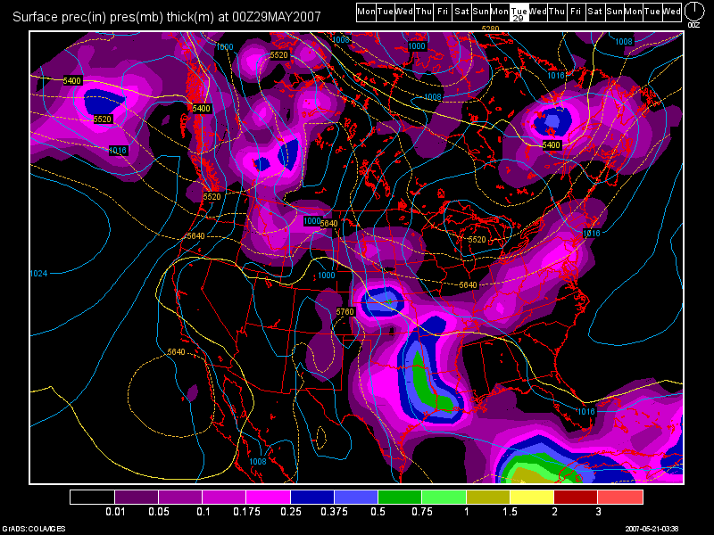
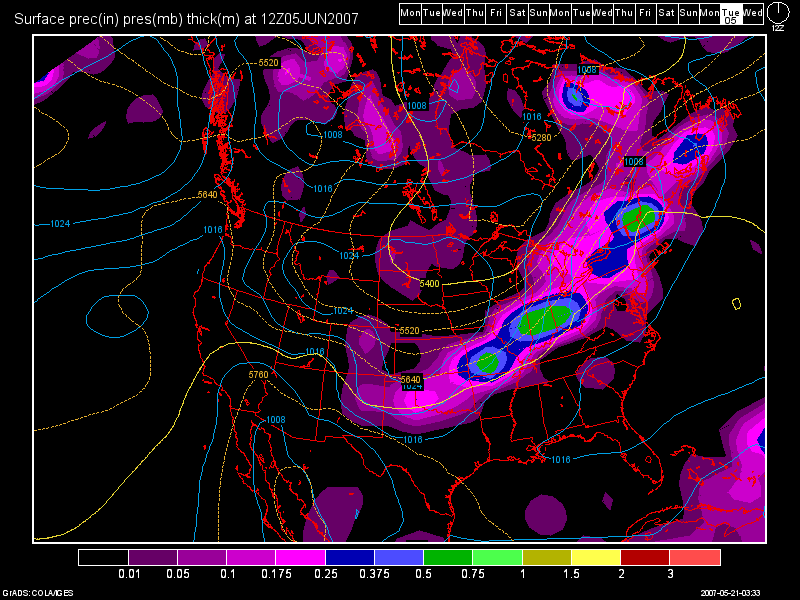
The next image is valid at 372 Hours, Tues June 5th at 8am. Another stronger cold front will try and push thru then. Being how far out in time this model is, forecast confidence will remain low. I won't be a bit surprised as time goes by, that the GFS will weaken it as well.
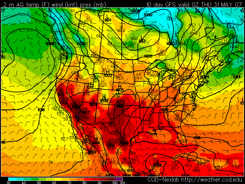
Finally, one more point to bring up on the drought situation... The American Models (GFS, NAM) last week where actually trying to show a trough developing in the Eastern US for the last week of May, and folks, that is NOT going to happen. The Euro Model is correct, keeping the ridge here and a trough out to the West. Over the weekend and continuing into the today, the American Models have jumped ship and now are in agreement with the Euro. All models now are showing a BIG RIDGE developing in the next 2 weeks with little chances at getting any decent rainfall. Highs could easily reach into the 90s as well. The last image that I wanted to show everyone, is the 0Z GFS surface temps. valid on May the 31st. Look at the heat building.

No comments:
Post a Comment