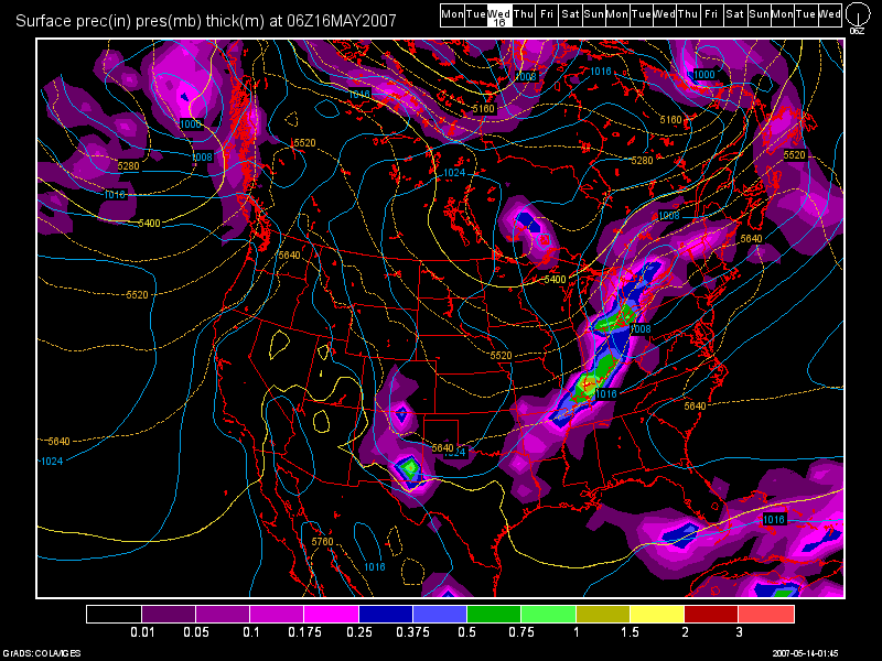
Well folks... the drought continues to develop over the Eastern US. Wildfires are burning in FL and GA and also add the Upper Midwest (MN and WI) to the list. We only have two systems to discuss at this point. The first system should be coming in Tues. night / early Wed. morning. The models have been consistent with bringing the front in late Tues. night. The best window of opportunity for us looks to be after midnight Tues. night thru the first half of the day on Wed. I have posted the 0Z GFS model run image below, valid at 54 hours (2am Wed. morning).

I think between 0.25" and 0.50" of rainfall is possible with this system. Unfortunately, this will do little, if anything, to ease the developing drought. The reason: We have no other storm systems coming in until the May 23rd-24th time frame. Our current weather pattern shows no signs of changing. I'll have more on the 2nd system a bit later.
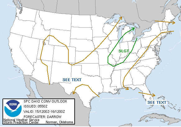
As far as the severe wx aspects go with our next system, checking the latest RUC model run (0Z), it shows some moderate instability in the region ahead of the cold front. Surface Based CAPES should be approaching the 1500 j/kg mark with a Lifted Index of -4. These two values show that we have some decent instability and lift present in the atmosphere. However, the shear values are weak. Upper level shear looks to only be around 10 knots and lower level being less then 5 knots. This will be working against severe wx development. Precipitable Water values will be approaching 1", so a few heavier down pours are not out of the question. I think the chances are slim, but I can not rule out an isolated severe storm or two Tues. night. The SPC seems to agree and here is their Day 2 Outlook below:

As far as temps. go, we'll see the lower 80s today, and the middle 80s for tomorrow. By Wed., the front will be moving thru in the morning hours, so temps. will be held in check and will be in the upper 60s for highs.
After that storm system, I see nothing happening for the remainder of the medium range forecast period. We can expect a moderating trend during the Thurs. thru Sun. period this week with highs in the upper 60s to near 70 for Thurs. and in the lower to mid 70s for the remainder of the period. Skies will be mostly clear during this time period.
Long Range Outlook (May 20th - 29th) :
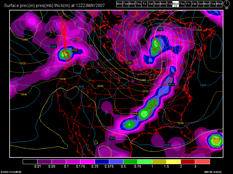
Again, as I've stated before, after our Tues. night/Wed. morning system, there is nothing going on at all until May 23rd-24th. This is the 2nd system that I mentioned at the beginning of the blog. This weather pattern just keeps repeating itself. Canadian High Pressure keeps dropping into the region behind each storm system that moves thru. The Pacific NW, continues to be under a trough, and that is causing a ridge to form over the Rockies and Plains States, plus the fact that the SE ridge continues to hold tough as well. Below, you'll find the 0Z GFS model run image valid at 228 hours (8am Wed. May 23rd) :

After that system, there is not much to talk about for the rest of the month. the 0Z GFS is hinting at possibly another system by month's end, but we'll see if that system still shows up when I do my next blog entry. Temps. during the long range period should start off in the upper 70s warming into the 80s ahead of the 23rd-24th storm system then back down into the 70s once again after it moves thru.
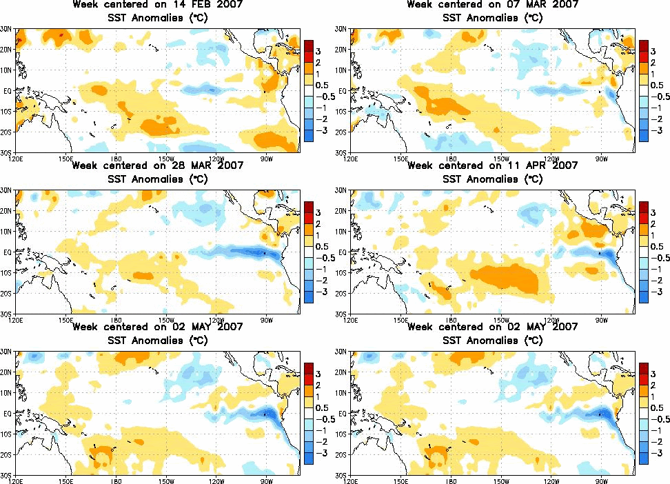
One final note that I'd like to discuss, is the developing drought. In my last blog entry, I talked about the developing drought briefly and I also posted the US Drought Monitor Map. Scroll down to see the US Drought Monitor Map in the previous blog entry. For this blog entry, I'd like to talk about the developing La Nina as well, which is also factoring into all of this. I'd like to post an animated image below of the Sea Surface Temps. (SST's) values off of the South American Coast. Notice the blue area expanding. We now have a weak La Nina in place.

If the La Nina strengthens further, which it is forecast to do so, then I think that this weather pattern we are in may not change. The good news is hopefully we can get some beneficial rains from any tropical systems that develop, as our rains during the summertime primarily come from T-storm development which is usually isolated to scattered in nature. I still expect above normal tropical activity in the Atlantic Basin this year.

No comments:
Post a Comment