Good morning everyone!
I apologize in advance for not posting a blog entry sooner. I celebrated my Birthday over the weekend, and was also out of town fishing a walleye tournament on Lake Erie as well. Unfortunately, due to strong Easterly Winds, the tournament was cancelled. But, it's been rescheduled for June the 16th.
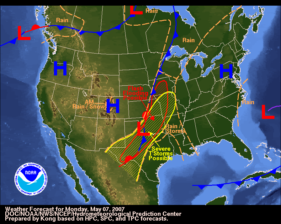
As far as the weather goes, a ridge should dominate our weather here in the OH Valley for the first half of the week, while the Plains States and Texas in particular, continue to get pounded by Severe WX. We have a blocky type of weather pattern in place at this time with continued troughs of low pressure coming into the Western US, which continue to spark off Severe WX out to our West. Meanwhile, we have a ridge of high pressure over the Eastern US, and another deep ocean low off the East Coast.
To better illustrate this, I have posted a surface map below:

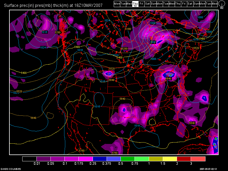
For temps. this week, I expect the 70s today, close to 80 tomorrow, and in the lower 80s for Wed. We can expect clear to partly cloudy skies all 3 days. By Thurs., a weak front tries to push into the region suppressing the ridge to the South. The fronts impact looks to be weak at this time. The 0Z GFS at 90 hours (2pm Thurs.) shows this quite well.

The 0Z NAM shows the area not receiving anything at all! I will side with the GFS at this time, and wait for future model runs to see if this weakening trend continues. The front will be slow to move through and should be off to our South on Friday. I've also been toying with the idea that this front could stall and bring us rain through the weekend as well, but the 0Z model runs do not show this idea like the 12Z runs did yesterday. If the 0Z run verifies, we'll have a nice weekend on tap. My confidence in the forecast is low after Day 5, so rain chances may need to be inserted past Friday if the front does indeed stall. I'll continue to monitor. For temps. upper 70s to the lower 80s look good at this point due to low forecast confidence.
Long Term Outlook (May 14th - 23rd)
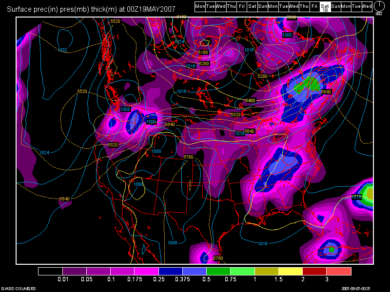
The models continue the domination of the ridge as a new ridge forms during the middle of the month and more troughiness affects areas to our West. A stormier pattern looks possible though during the 3rd week of the month. A stalled out front to our South looks to return North as a warm front and bring rain and storms to our area May 18-20th. Here is another 0Z GFS model run image valid at 288 hours (Fri. May 18th, 8pm) :

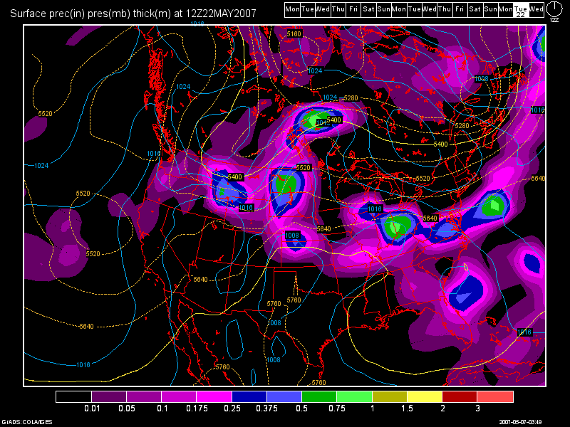
Then, the flow backs to the SW again in response to more surface low development out in the plains towards the end of the long term period. The front will finally try and push through, but due to the SE ridge, it'll have a hard time doing so. I have one final 0Z GFS image to show you. This one is valid at 372 hours (Tues. May 22nd, 8am) :


2 comments:
Awesome as always, don't you just love these sunny weeks :-D
When I'm fishing I do, but otherwise we could use a little rain down here in KY. Ground is somewhat dry now. I had to water the newly planted beans and tomotoes this evening.
Post a Comment