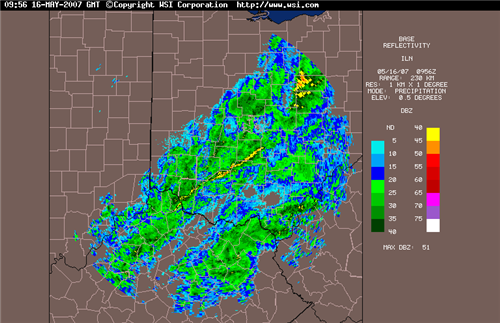
Well, as expected, the severe weather reports were isolated in nature. Dearborn Co. in SE Indy had some 3/4" hail reported and also some trees knocked down. A few other reports were noted in the Tri-State as well, but they were isolated in nature. Most of us saw heavy rain, and wind gusts to 40 or 50mph which is below the 58mph severe t-storm criteria. The overnight rains are still ongoing as I write this blog. However, in the next hour or two most of it will be gone. Below, is a radar image as of 6am:

After the cold front passes thru early this morning, we can expect partly to mostly cloudy skies and highs in the middle 60s today. Tonight and tomorrow, another weak piece of energy will rotate through the Tri-State from the NW. It will drop SE across the region during the day on Thurs. This upper level disturbance should have enough instability associated with it, to touch off a few showers and maybe even an isolated T-storm as well.
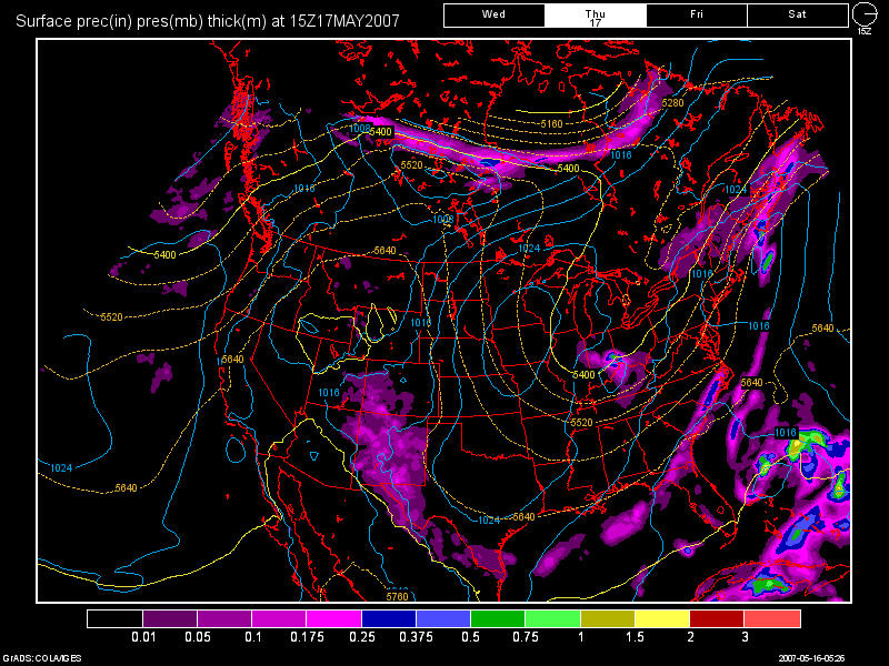
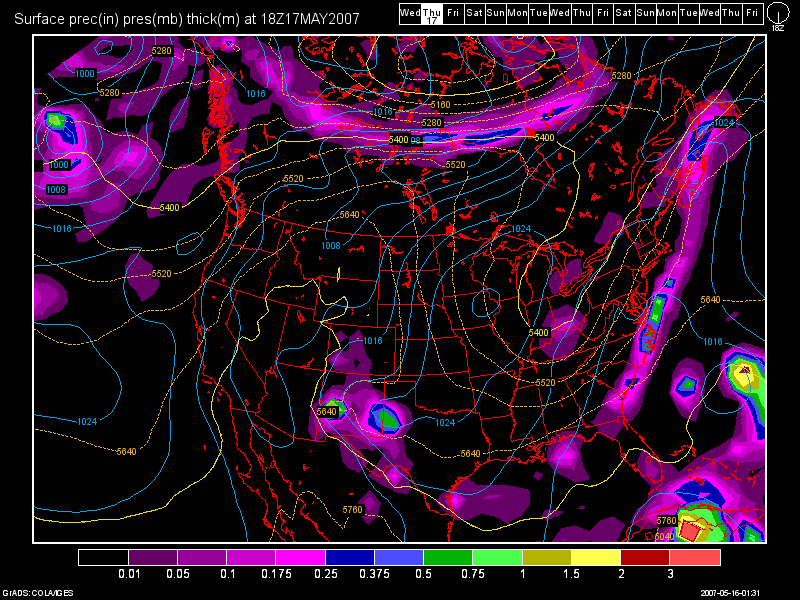
Below, I present to you the 6Z NAM run for tomorrow, valid at 33 hours, followed by the 0Z GFS run for tomorrow valid at 42 hours. Note, how the NAM is again overdoing the amount of precip. It did the same thing in regards to the system that's pulling out now as we speak. The NAM was going for over an inch of rain, while the GFS was right on the money with .25-50"! I will side with the GFS for tomorrow's forecast as well, and I think most everyone will not see very much rain at all. I think a tenth on an inch or less as the GFS suggests should cover it.
6Z NAM:

0Z GFS:

Highs on Thurs. will also be in the mid to upper 60s. By Friday, sunshine will return along with a slow moderating trend. Highs on Friday should be close to 70 and for the weekend, I expect dry skies and highs in the lower to middle 70s.
As we start a new workweek, clear skies continue for both Mon and Tues, and highs in the upper 70s both days, maybe cracking 80 by Tues. can be expected as another Canadian High dominates our weather picture.
Long Range Outlook (May 23rd - May 31st)
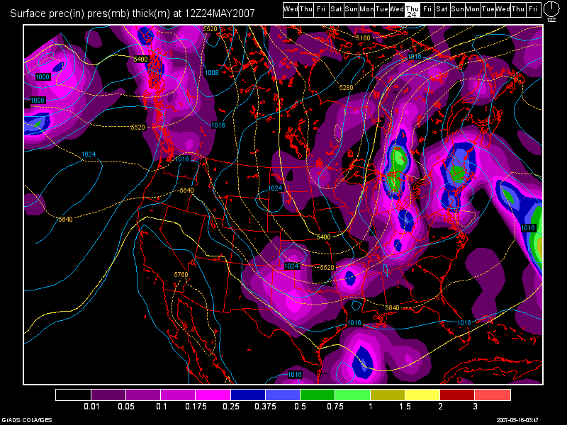
Again, there is little to talk about during the long range assessment period. The models still show nothing going on until the end of next week. During the May 24-25th time frame is when our next good threat of rain will be. So, whatever rains we received from today's system and tomorrow, will quickly dry out and be a memory. I have posted the 0Z GFS run valid at 204 hours, and even here, the system does not look as impressive as it once did.

After this system, another dry spell which should last until the end of the month. The GFS is still hinting though at another system by the 31st, which is what I mentioned to you as well in my last blog entry. That system still looks weak however.

2 comments:
Awesome as always! Woot for no rain :P
Hey Nick.. thanks for responding as always! Yeah... check out the new US Drought Monitoring Map from today. Areas S ad E of Cincy including all of KY, are now in a D0 Drought status.
http://i162.photobucket.com/albums/t241/tron777/Drought.gif
Post a Comment