After a dry weekend, the dryness continues into next week. High pressure will remain in control. Temps. and humidity will not be as high this week, as we have experienced in the past 2 weeks. The Burlington Weather Office did record another 100 degree temp. today! This makes the 4th one this year of 2007. I topped out at 101.0 as of this blog entry. That should be the high for today.
On this afternoon's weather map, a cold front extends from Michigan SW to just North of Chicago, Iowa, and Nebraska. Thunderstorms pushed thru Michigan this morning. High winds, small hail, lightning, and very heavy rain occurred. Winds this morning gusted to 50 mph. Over us, high pressure continued to rule. The heat ridge has retrograded off to the West and will remain over the Central Plains this week. Check out my Surface Map below.

The 90s will continue this week, but the humidity will be lower then in the past week. Our next front looks to affect the region on Thursday, late in the day. The models are keeping most of the energy to our north, as has been the case for most of this year. The front looked stronger also a few days ago. But, the models are trending weaker with this system, so I have only included a 30% POP for Thurs. afternoon in my 7 Day. Below, is the 12Z GFS's take on the front valid at 102 Hours.

High pressure and somewhat cooler temps. will move in behind the front. The Euro brings us much cooler air for the end of the week, but the GFS has strayed away from that idea. I did take temps. below 90 for Sat. as the GFS MOS Guidance shows mid 80s, and I think with the front being weaker on Thurs. then earlier predicted, that cool push of air behind the front, should not be as cold as what the models are predicting.
The 12Z GFS brings in another weak front for Sat., but I am keeping the forecast dry at this time, due to model uncertainty and also due to the fact that it's so far out in time. Here is the model image valid at 138 Hours.

Here is my updated 7 Day Forecast:

Long Term Outlook (Aug 20th - 28th)
The long range period begins with another Great Lakes MCS Aug 20-21st. A trailing cold front looks to deliver us another shot at rainfall. Meanwhile, the models still show a tropical system affecting Southern TX or Mexico Aug 23-25th. I'll touch on this in greater detail below. For us, more high pressure and dry weather remains for the rest of the forecast period. The Drought Monitor Map, which will come out on Thurs., should paint a pretty grim picture for the region.
Could Dean form in the Tropics?
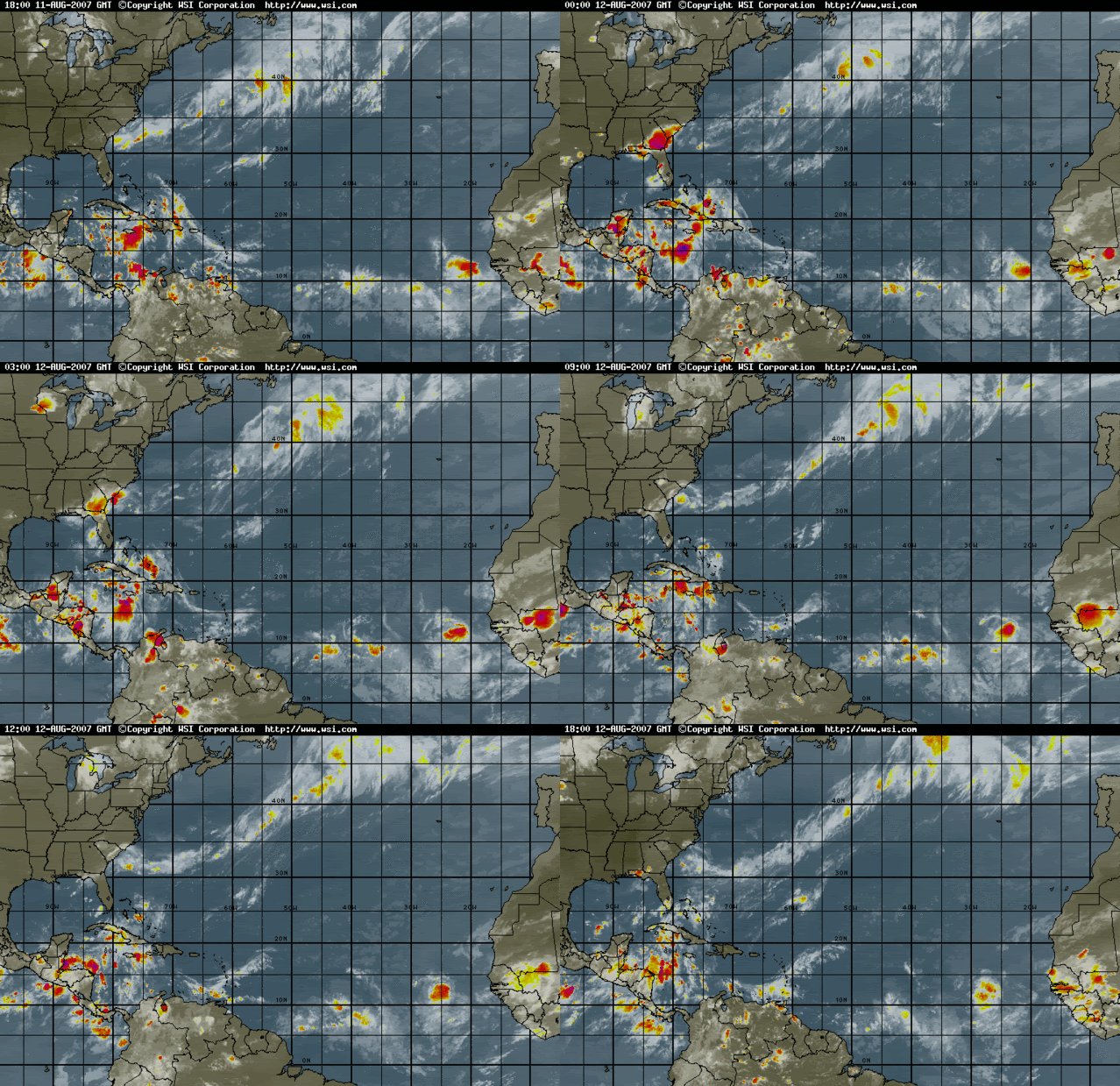
The models have been consistently showing that a tropical wave off of Africa will develop in a few days possibly becoming a Depression and then Dean! Here is an IR Sat. image of the Atlantic Basin and you can clearly see a tropical wave off the African Coast.

As you can see, the system has great circulation with it, and it should be heading into an environment which will be more favorable for development. However, note the lack of convection with this wave. I think that it will develop into a depression in the next 2 or 3 days, and then eventually become Dean.
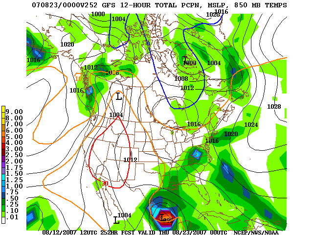
The models are showing the system eventually tracking thru the Caribbean Sea and into the Gulf of Mexico by Aug 23-24th. It may even strike Southern TX or Mexico! Here is the 12Z GFS's depiction of it valid at 252 Hours.

The GFS has been all over the place with the track of this system. 4 or 5 days ago, it had the system tracking towards the East Coast, then deflecting it back out to sea. Then it had it hitting Florida. Now, the model takes it thru the Gulf and into S. Texas or Mexico as you can see from the above image. I'll continue to monitor this tropical wave, and it if becomes Dean or not.

No comments:
Post a Comment