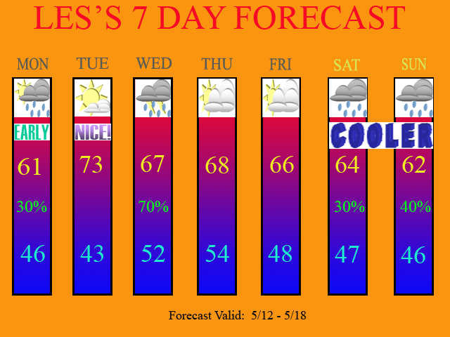
After a stormy Mother's Day today, another system will move into the region by Wed. Then, could we see some scattered rains by next weekend? Watch my NEW Video Forecast for all of the details!

This blog is designed for dicussing the weather and analyzing the models.

8 comments:
Hey! Where did you get your lifted index model runs? I don't know how to get certain models, could you tell me where you get that tstorm lifted index model run? Thanks!
Hey Scout... I got them off of another model website. You can see the severe wx parameters for both the GFS and the NAM.
http://raleighwx.easternuswx.com/models.html
Which one is the thunderstorm model? I'm so stupid!
On that website, with the NAM, you can look at the instability (CAPE) and PWATS's. With the GFS, you can view, that plus the LI's as well. Both models show all of that information, but on that particular website, that is all that is populated.
Sorry for asking questions, but I have one more. If you don't want to answer it, that's fine.
Where did you find the instability model runs? I always hava trouble forecasting severe weather. Wher did you find it? I would like to know it! Is it on that weather model site in one of the eariler comments? Where???
On that site...
http://raleighwx.easternuswx.com/models.html
Click on whatever GFS or NAM run you want to look at (0Z...12Z etc).
It's under the Severe WX Plots heading, and labled as Best Lift Index/BL(Boundary Layer) Winds and Surface CAPE/CINS For PWATS, look under the Misc. Plots header.
Thanks! You rock!
Post a Comment