Well folks, we did see a little bit of rainfall today, but most areas saw very little. Here at the Weather Office in Burlington, I picked up 0.18" and CVG picked up 0.23". Temps. are now rising rapidly, as we are now up to 91.6 as of this blog entry, and CVG is now up to 88 degrees as of the 3pm reading. The dew point, (DP) or measure of the amount of moisture in the air is at the highest level for 2007! The current DP is at 77, which generally can be found along the Gulf Coast! We truly have a tropical air mass in place across the Tri-state.
So, what can we expect for our upcoming work week? More of the same. I expect this dangerous heat and high humidity type of weather pattern to continue. The 12Z GFS model run showed no relief from the heat. Below, is a surface map that I made this morning.

As you can see, there is a trough over Western Canada and the Pacific NW. This is causing the Heat Ridge to move Eastward and take up residence over the SE US. The warm front is now to our North. It currently runs across Northern Indy and Northern Ohio, and should stall this evening in that region, or perhaps over Southern MI.
As I stated in my last blog entry, the storm track should remain to our North. However, even the Great Lakes will not be seeing as many MCS's as the models once showed. This heat wave will be affecting the Central/Southern Plains, and most of the Eastern US as well. We have not seen heat this extreme and humidity values this high for a long time now. The 12Z GFS MOS Guidance showed 99 or 100 by Thursday for CVG. I am not going that high due to afternoon cumulus cloud development and high humidity values. I do not think that we will crack 100 this week. Some home thermometers may do so, but not any official reporting stations, such as CVG. If you want to find a 100 degree temp. then go to Louisville down to Evansville, IN. That area should crack 100 by Wed and Thurs of this week.
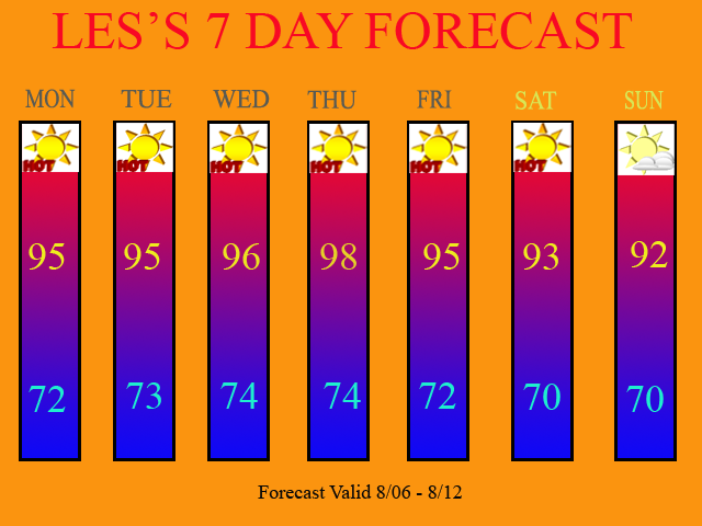
Here is my updated 7 Day. I left all POPS out of the forecast. The 12Z runs have taken away all precip. chances. Now, from time to time, we may get a pop-up afternoon storm, but the coverage will be so isolated (less then 10%) that I have dropped all POPS from the forecast.

Long Term Outlook: Aug 13th - 22nd)
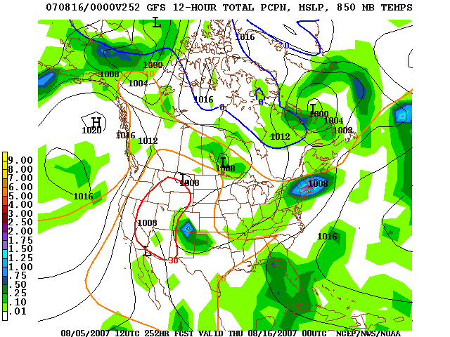
The 12Z GFS continues this pattern with no relief in site. The only significant chance at rain that I could find is on Thurs., Aug 15th. This particular front still looks to have most of its moisture to our North. Here is the 12Z GFS model image valid at 252 Hours.

I look for the drought to worsen as most of the Tri-state, South of the I-275 Loop in Ohio, should be in a D2 status by our next Drought Monitor Update, with D3 probably coming back to Southern KY. CVG is currently over 10" below normal in rainfall for the year. We can not turn to the tropics for help, as there is absolutely nothing going on whatsoever. Last year, the tropics were dead, and this year is turning out to actually be quieter then last year.

2 comments:
I bet even you are getting tired of reporting the same old thing every day, HOT HOT HOT HOT!!!!!
I am actually. I'd like to be able to report some rainfall and/or severe wx.
Post a Comment