Well, if you like the 90s for highs and no rainfall, then you will enjoy reading this blog entry. The forecast will be right up your alley! If you dislike this kind of weather, well, please continue to read the blog anyways.
Our current weather pattern is depicted by my Surface Map graphic, which is shown below.

As you can see, the jet stream is in its typical summertime position, which runs along the US/Canadian Boarder. You can also see how much of the country is dominated by high pressure. Now, what I want you to pay particular attention to, is the top part of the ridge, which I have labeled as "flat." What that means is that there is a portion of the ridge where our storm systems will continue to track along, a weakness in the ridge if you will. Storm systems will continue to track well to our North over the Great Lakes region. Basically, this leaves us underneath the ridge and stuck in this hot and dry pattern.
The 0Z GFS model from last night was showing some decent rainfall for us this Sunday, as the cold front was supposed to break down the ridge and push all the way down to the OH River. The 0Z NAM showed the opposite. It kept the cold front at bay to our North. I figured the GFS run to be a bogus run. I was right. Check out the 12Z GFS run from this afternoon for Sunday. You'll notice how it too agrees with the NAM model and keeps the front and its associated precip. to our North.

Therefore, I expect Sunday to be dry for us with the storm track up to our North. As we continue thru next week, I expect more of the same. By Wed. and Thurs. I did insert a small 20% POP into the forecast as the models are showing a slight, and I mean a slight chance of a few afternoon pop-up storms as another front tries to make it down here. As you can see by the 12Z GFS model image, which I have posted below, the main storm track continues to be over the Great Lakes, as storm systems continue to track along the top, or flat part of the ridge. Below, you will see the 12Z GFS model run for Thursday.

My updated 7 Day Forecast can be seen below.

Long Term Outlook (Aug. 10th - Aug. 18th)
The long term outlook features this same weather pattern. I see no change in site at this time. Storm systems will continue to ride off to our North only delivering us a glancing blow, and small chances at t-storms. I see no improvement for the drought whatsoever.
Drought Update:
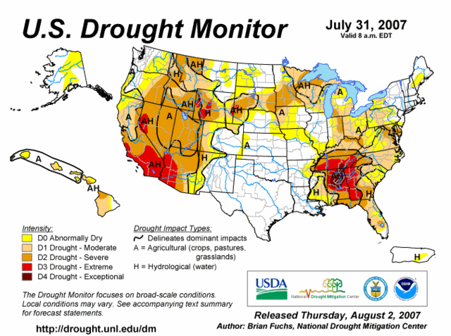
Speaking of the drought, here is the updated Drought Monitor Map as of 7/31/07.

As you can see, we have seen significant improvement. The D3 area is gone as far as KY is concerned, and a lot of the D2 areas, have been downgraded to D1. You can see though an area of D2 status, which runs along the OH River. Further North, the drought continues to intensify and expand. My drought outlook calls for the D2 area to continue to expand over our region, with a return to D3 status in Southern KY once again. I am forecasting this to occur within the next couple of weeks.
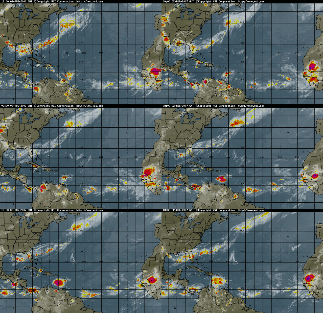
The only thing that can save us now are the tropics. I do not see that happening at this time. The tropics remain very quiet as conditions are not favorable for these tropical waves to develop. Check out this IR Satellite image of the Atlantic Basin.

Also, we would need a stalled out front to sit right on top of us for a while to deliver us some soaking rains. The models are just not showing that occurring at this time. The only chances the models are showing are isolated afternoon storms, which will only benefit localized areas that receive them. Basically, keep your A/C in working order and try and stay cool over the next several weeks.

2 comments:
HOT! HOT! HOT!
Great graphics, but I wish you had rainy information to tell us.
Sorry... I just do not see that happening at all. A few spotty/isolated chances is all that is showing up on the models at this time for the Tri-State. I look for the 90s to continue as well.
Post a Comment