Well folks, the drought is not going away, however, I do think that it will not get any worse for the next couple of weeks. When we had a few MCS's affect the region starting back on Fri. of last week, they changed our whole weather pattern now. Instead of seeing a mini heat wave develop, like I was forecasting last week, this week, we will have more humidity in the air, more instability, and almost a daily threat for showers and storms. I only see 2 days over 90 degrees this week, and that will be Tues and Wed before our next cold front moves in.
Before we get to the models, I thought that the weather office might receive a T-storm this evening, but it was a bust. Here is a radar image that I saved from GR3 as of 8pm.

The cell tracked from between Union and Walton in Boone Co, and moved into Independence in Kenton Co. It then rolled into Campbell Co. as well where they desperately need the rain. The cell dropped between 0.15" and 0.45" based on radar estimates. Otherwise, most areas didn't get much but a few sprinkles or very light showers today,
For tomorrow, I think a slight chance of storms is possible in the afternoon. The 12Z GFS shows the moisture mainly North of the OH River, so I went with a low POP on
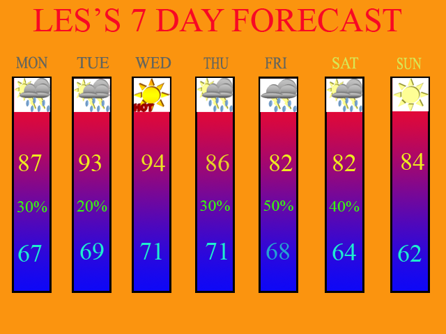
the 7 day, but the best chance of getting rainfall for Mon. will be North of the OH River. The same thing for Tues. but the chances are so low that most everyone will remain dry. Thus, my reasoning for raising the temps. into the 90s. Wed. is going to be another hot one as well, although an isolated storm could still occur. The threat is less then 10% though.
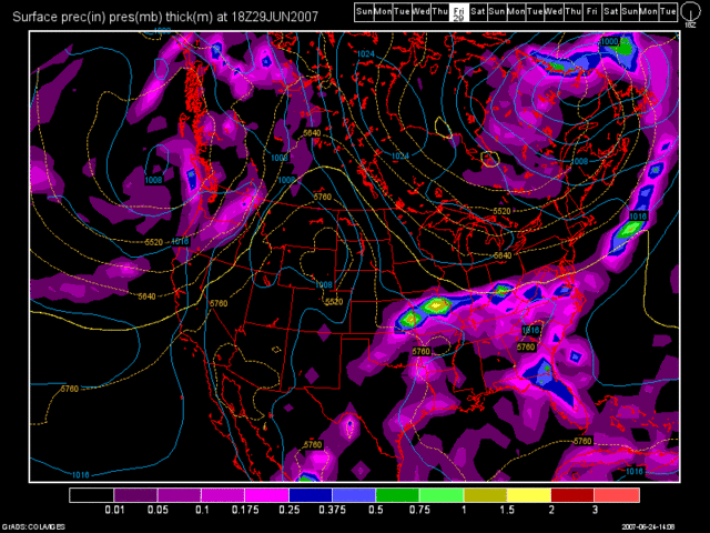
By Thurs. a cold front should be beginning to move into the OH Valley from the North. Fri. looks to be our best chance of rain though as the cold front is supposed to stall out near the OH River, or just South of it. Here is the 12Z GFS valid at 126 hours for Fri. 2pm.

The 6Z GFS from today actually had the front moving south of the region and providing us with a nice weekend. However, the 12Z GFS from this afternoon actually slows the front down until Sat. morning. So, the model trends have been to slow down the front. Thus, I have POPS in for Sat. as well. Sun. it this point looks cooler and less humid behind the front.
Here is the new 7 Day valid for June 25th thru July 1st.

Long Term Outlook (July 2nd thru 10):
At the beginning of the long term period, high pressure briefly builds in. However, by July 3rd and 4th another front looks to move in. However, at the present time, it looks weak and the moisture looks scattered with it. This, naturally will change, but that's what's going on at the present time. Then, yet another front for the July 7th and 8th time frame as well. Again, this far out, it could change.
July 4th Preview:
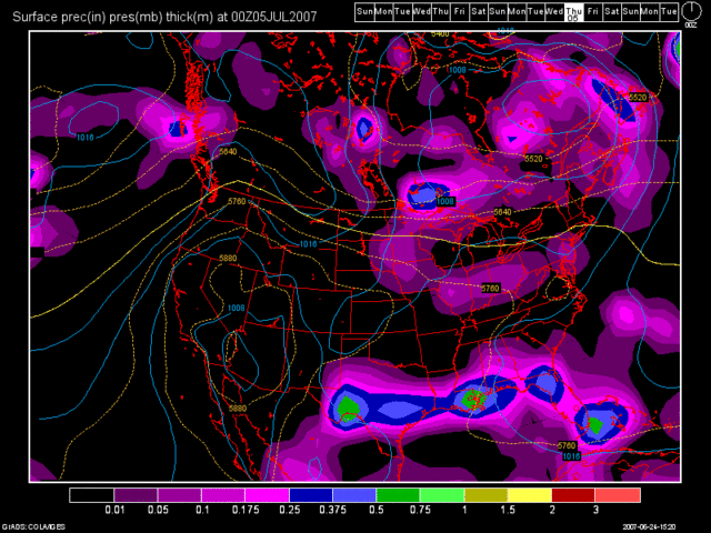
Here is the GFS image from the 12Z run for your viewing pleasure. This is valid at 252 hours for July 4th at 8pm.

Again, do not buy this model run as it'll change. Currently, I'd have to say a 20% chance of rain is in order for July 4th at the present time. No need to cancel any fireworks shows at all the way it looks right now.
SIDE NOTE: This will be the only 7 Day and Blog Update for this week, as I will be on another fishing trip to Saginaw, MI. The Blog and 7 Day updates will resume after July 1st.

No comments:
Post a Comment