I'm back from my vacation now, so 7 day forecast updates and blog updates will now resume. My weather highlight to report to you since I was gone, is that I dumped out 2" of rain in the rain gauge at the Burlington Weather Office. It looks like the Tri-State received some much needed rain as I expected. Also, in Michigan, we had two different severe T-storm warnings for Bay Co. One of the storms I experienced first hand. We did not make it back in quite in time before it hit. I was in the Au Gres River at the boat ramp waiting for my Brother to pull the boat out of the water. As he went to get the truck, the storm came. I experienced 1/2" hail covering the bottom of the boat along with wind gusts to 60mph! The hail hurt too when falling from the sky, but no damage was reported.
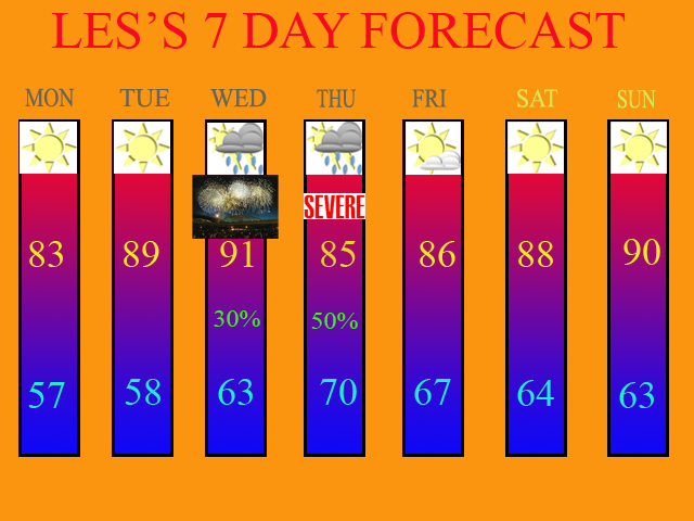
As far as our weather is concerned for this week, high pressure should rule for tomorrow and Tues. Mid 80s should be the high for tomorrow with temps. getting close to 90 on Tues.
Our next chance of rain could come on the 4th of July itself. The best chance should be overnight, and most fireworks displays should be fine. The model is showing most of the precip. to be North and NW of Downtown Cincy, so KY residents may remain dry during the evening hours. I am leaving a 30% POP in the 7 Day just in case.
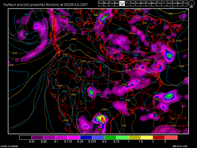
Our greatest threat of rains looks to be on Thurs, July the 5th. Severe WX is even possible here, so I went with "Severe" wording in the 7 Day as well as 50% POPS at this point. I'll continue to monitor this for you. Below, you'll see the 12Z GFS Model run image valid at 90 hours, which is for Thurs. morning at 2am.

High pressure should build back in once again for the remainder of the 7 Day period with moderating temps. back to 90 by Sunday.
Below, you will find my latest 7 Day Forecast. It is valid 7/1/07 thru 7/8/07.

Long Term Outlook (July 9th thru July 17th)
High pressure should be in control for the start of the long range period. Another decent front could possibly affect the region on July 10th and 11th. Here is the 12Z GFS Model run image valid at 228 hours, which is for July 10th at 8pm.

After that front moves thru, high pressure should again build back into the region, with some of the models showing the Western US Ridge (major heat dome), possibly moving back into our region after July 10th. If this comes to pass, then we should see hot and dry weather and an end to our drought relief.
Drought Update:
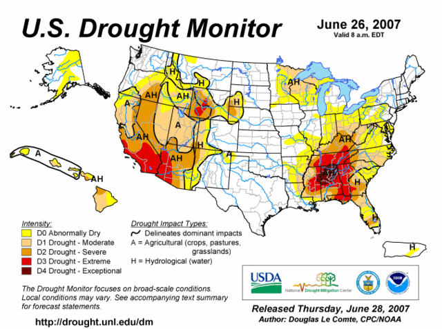
Here is the latest US Drought Monitor map from 6/26/07.

As you can see by this map, the drought areas did not get any worse in the OH Valley. So, some improvement has been received in a lot of areas. This by no means is an indication that the drought is over. We are just seeing enough moisture so that it does not get any worse. It will not get better though unless we see more rain and less dry spells in between systems. This part of the pattern is what we need to have break. I do not see this occurring at this time. We'll see a front, then 3-5 days of dryness before the next one moves in. D0 areas have also expanded into Southern Michigan as well.

No comments:
Post a Comment