The models have been in disarray as of late, but now the GFS and the NAM seem to be in good agreement with our next weather system scheduled in here by midweek. Before we get to that, we have one more hot day to go tomorrow. The GFS has 95 for the high, but it over did the heat for today and had 94 as its forecast high for today, but CVG only made it to 90 today. We will be starting out cooler in the morning as well, so I knocked a couple degrees off of tomorrow's forecast high.
The models bring in some instability for Tues. afternoon so chance POPS have been inserted into the 7 Day for Tues. afternoon. These will be hit or miss as far as the coverage is concerned. The models have sped up the cold front to Wed. now, so I went with likely POPS there.
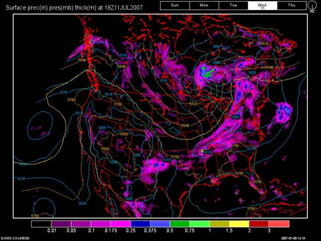
The 12Z NAM is lower on precip. amounts then the 12Z GFS. Below, you will see the 12Z NAM and 12Z GFS runs valid at 78 hours. (Wed. at 2pm) I sided with the GFS for this forecast package.
12Z NAM

12Z GFS

After the front moves thru, there could be a lingering shower very early Thurs. morning. Any activity will be long gone before the morning commute so I left in slight chance POPS for early Thurs. morning. Fri thru Sun all appear to remain dry at this point as we will be under a NW Flow aloft with lower temps. and humidity values.
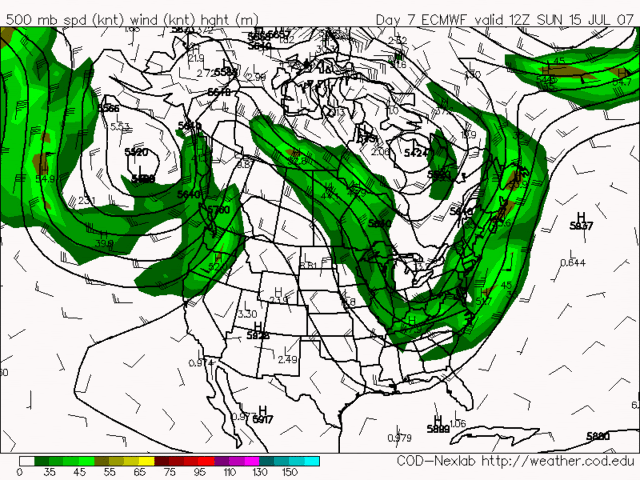
This next image is of the 12Z Euro model run valid at 168 hours. (Sun 7/15 at 8am) You can clearly see the big trough in place over the region.

Here is my updated 7 Day Forecast for your viewing pleasure.

Long Term Outlook (July 16th - 24th)
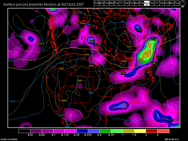
Our next decent chance of rain does not come into play until we get to the 17-18th time frame. A disturbance is forecast to drop down from the Great Lakes region. The majority of the energy with this system appears to stay to our North and NE, so the rain chances here do not look all that impressive at this time. This model shows New England getting nailed by this system, although being this far out in time, I wouldn't even trust it. But I do agree with the model trends though of this system not bringing us very much rain the way it looks right now.
Here is the 12Z GFS model image valid at 228 hours. (Tues 7/17 at 8pm)

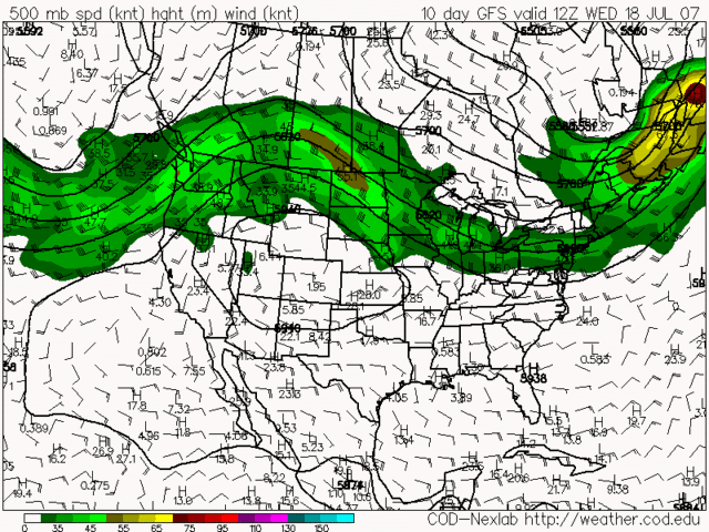
Beyond that system, there is really not too much to talk about. The Storm Track remains running from the Northern Plains thru the Upper Midwest and Great Lakes then into New England. The jet stream is forecast to pretty much remain in a zonal flow. The final model image that I have to show you is from the 12Z GFS run. The image is valid at 240 hours. (Wed. July 18th at 8am)

In regards to our drought, I am not going to post the latest Drought Monitor map that came out last Thurs. because it is similar in nature to the one that I posted in a previous blog entry. The recent rainfall that we have received is only stopping the drought from getting worse. It is not improving it in regards to erasing it. Also, due to the hot dry air we have seen yesterday, today, and tomorrow, that will erase a lot of the ground moisture that we have accumulated recently. The drought has also expanded with D0 areas half way up the Lower Peninsula of Michigan. I am forecasting the drought to probably get worse again before it gets better. We are heading into the driest months of the year now (July, Aug, and Sept), and if the jet stream remains in a zonal flow for a long period of time, then we are in a world of trouble. CVG is still running at almost 7" below normal in the rainfall dept. since March 1st.

No comments:
Post a Comment