Good evening everyone! I'm back at the Weather Office here in Burlington, KY, now. As promised, I do have an updated 7 Day forecast in this blog entry. I also have created a few "home made" graphics as well.
After a beautiful weekend, a cut off low pressure system will affect the region this week. A cut off low is a low pressure system that is "cut off" from the main jet stream flow. The jet stream currently is situated way off to our North at the present time. This low is currently situated over VA/WVA and will slowly track NW and affect us in the OH Valley from Tues until Sat. A cold front will come thru on Sat. and finally clear all of the moisture out of the region.
Below, I have made a graphic depicting the upper level winds over the US, and as you can plainly see, the jet stream is located way off to our North. We also have a ridge of high pressure centered over the Western US. The cut off low is over VA/WVA at this time.

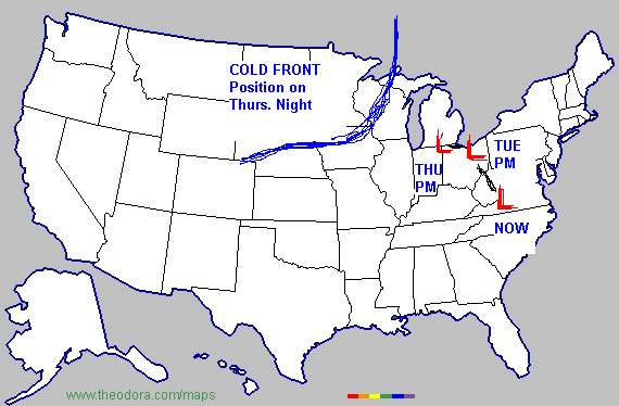
The next map I'd like to show you is the track of the cut off low. This is where I think it'll move over the next several days.

For Tues. the low will be too far away to bring us much rainfall. The best chance will be to the SE of Cincinnati. Therefore, I only have 20% POPS on Tues. For Wed. and Thurs., the POPS will slowly increase.
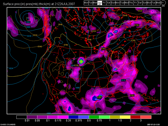
Below, is a model image of the 12Z GFS valid at 81 hours. (Thurs. at 5pm)

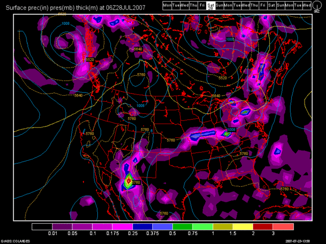
Here is another 12Z GFS model run image valid at 114 hours. (Sat. morning at 2am)

As you can see by the above image, the cold front will begin to move into the region. I have Sun and Mon. dry at this point as high pressure should move into the region behind the cold front.
Below, is my updated 7 Day Forecast.

Long Range Outlook (July 31st thru Aug. 8th)
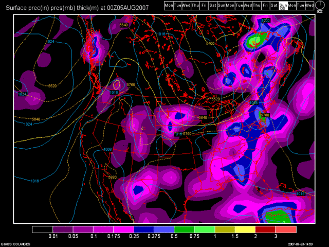
At the start of the long range period, high pressure will dominate the region. Another cold front is shown by the 12Z GFS at 300 Hours. (Sat. Aug 4th at 8pm)

Another area of high pressure will move in behind that front for the remainder of the long term period. The drought has improved significantly for the region over the last week. It may continue to improve based on how much rain the cut off low brings us this week. However, CVG is still running almost 9" below normal since March 1st, and we have a lot of ground to make up yet.

No comments:
Post a Comment