Good morning everyone!
At the Branch Weather Office in Oregonia, OH, we picked up some nice rains overnight. I even heard some thunder as well. I can not give you an accurate rainfall amount, since I do not have any weather equipment there, but according to radar estimates, 0.25-0.50" fell over Warren Co. The heaviest rains fell North of I-70 overnight where as much as 2-3" of rain was recorded!
This morning's radar shows the rainfall all to the North of I-70 extending from Nebraska, all the way into Western PA. We will have to keep an eye on the radar today to see how that large swath of rain progresses. It will be interacting with a cold front, which will sag South towards the Tri-state today. We do stand a shot of seeing some severe wx this afternoon. I have a lot of images to show you today.
First, we'll start off with the SPC's probability map for today. We have a 15% chance at large hail and a 30% chance of damaging winds. The image below, is the wind threat map.

The next image I will show you is the 0Z Soundings for ILN (Wilmington).
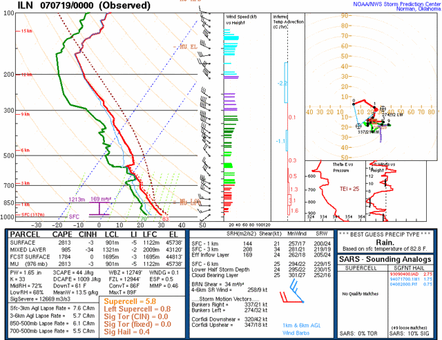
The SB Cape looks great as it is over 2500 J/kg. LI is at -5, so the lift looks good. 6KM shear (at the surface) also looks somewhat impressive at 25 knots. PWATS are at 1.65" so heavy rain is likely with any storms that form. Wet bulb is at 12 feet, so large hail is also possible.
What worries me is that even though the severe wx parameters look good for today, the only fly in the ointment is the debris clouds from the T-storms to our North and West, which I mentioned earlier extend all the way West to Nebraska. Let me show you the latest satellite pic, and you'll see what I mean.
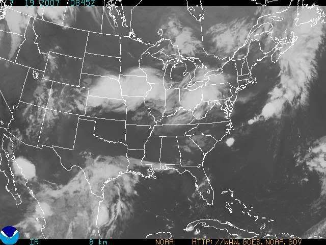
This can hurt our chances of getting some nice instability in here. However, the majority of the atmosphere was not affected by the overnight convection here in the Tri-state, so we have that going for us. If we can get some sunshine today, then watch out come this afternoon. Things could certainly get rocky around here. If the clouds hang tough, then it'll be a bust. My current thinking is that the further South you live in the Tri-state, the better chance you'll have at getting severe wx since your location would be furthest away from the cloud cover. Northern KY stands the best chance at getting severe wx in my opinion today.
As far as the timing of the front goes, the 0Z NAM has really sped up the progression of the front. Check out this 0Z model run image valid at 18 hours (Today at 2pm).
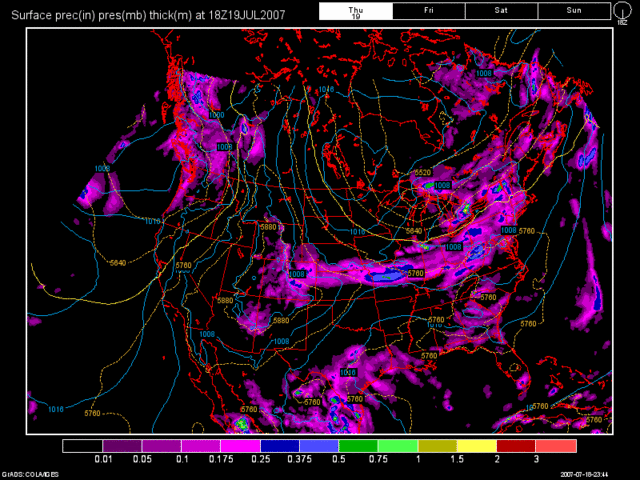
It has the front moving into the region by then and blowing it thru here by evening. The 0Z GFS, paints a much different picture and has the front affecting the region this evening, about 6 hours or so slower then the NAM, with a complex of storms affecting locations North of the OH River. Here is a model image valid at 24 Hours (Today at 8pm).
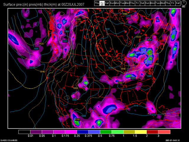
I personally agree with the GFS's solution here as it has been consistent with the majority of the models. The NAM is the odd ball model at this point in time. I think we stand the chance of seeing a pop-up storm at any time today, but they should become more widespread after 5pm today.
After this front moves thru, we should see a beautiful day tomorrow with some afternoon cumulus development. No rain is expected though. We'll see lower humidity values as well. The weekend looks WONDERFUL too, so get on out there and enjoy it. The dry weather pattern will continue for the beginning of next week as well with temps. warming back to 90 degrees by Tues or Wed.
Long Term Outlook (July 26 - Aug 3rd)
The GFS has shown nothing in terms of rainfall for the rest of July. It has been consistent in showing that all week long. Whether our rainfall for today occurs or not, the fact of the matter is, is that the drought will intensify for the entire region once again. I think highs in the lower to middle 90s is likely by the end of next week, and no rain for the rest of the month appears likely at this point. In fact, nothing thru August the 1st according to the 0Z GFS.
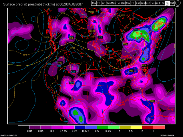
It finally does bring in a cold front by the end of the long term period, but honestly, you can not trust that whatsoever this far out in time. But, just for kicks, here is the model image valid at 360 Hours (Thurs. Aug 2nd at 8pm).
SIDE NOTE: The 7 Day forecast graphic should be returning with next week's blog entry.

No comments:
Post a Comment