Well folks, our Tues./Wed. rainfall event was beneficial in some areas and a bust in others. Locations North of the OH River received anywhere from 0.25" to local amounts of 1.5". The hardest hit areas generally were along and North of I-275 in Ohio. So, who missed out on this rainfall? You guessed it! Northern KY!!! CVG recorded only 0.02" for the entire event. Here at the weather office in Burlington, we received no rain on Tues. and a few light showers during the pre-dawn hours this morning. I'd estimate that I recorded less than CVG, which is pathetic.
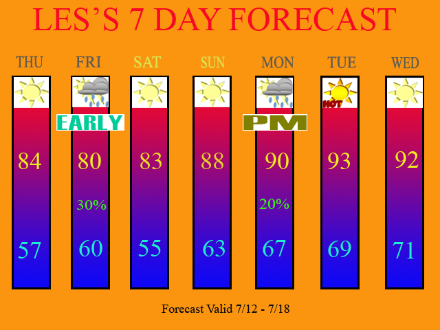
So, what's next? For tomorrow, I expect a beautiful day with low humidity and sunny skies. We have another cold front headed our way from the NW and it should arrive in the Tri-state late Thurs. night/early Fri. morning. I am not expecting a whole lot of rain with this system. I am only forecasting 30% POPS in the 7 Day, and even that might be a little bit too high. Only isolated showers and storms are expected with this front. What it will do though is provide us with a beautiful Fri. afternoon with cooler and less humid air. That should continue on into the weekend as well.
Below, check out the 18Z NAM model run. It is valid at 33 hours, which is Thurs. night at 11pm.
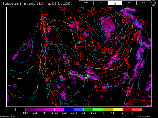
As you can see by this model run, the precip. out ahead of the cold front is just starting to enter the Tri-state. Note the precip. amounts here. The model is forecasting less then 0.25" for us.
Now look at the 12Z GFS model run for the same time period.

It shows nothing for us because the front and precip. are well off to our North. It has a much slower progression of the front but also brings in less precip. as well. If you side with the GFS solution then it shows between 0.10-0.15". I am siding with the GFS here as the NAM tends to overdevelop systems anyways. Also, due to the dry airmass we will already have in place starting tomorrow, I am only expecting a few lucky folks to get rain.
After that, as mentioned above, the weekend looks WONDERFUL! Low humidity can be expected and we'll see lots of sunshine. As we start the new workweek, we'll start to see an increase in humidity as well as temps. I have inserted a 20% POP in the 7 Day for Mon. afternoon. The reason being is that the 12Z GFS shows a system off to our South. I think that Central KY on Southward should see some decent rains Mon and Tues of next week. For us, not much, if anything at all. I have POPS for Mon. afternoon as I think enough moisture and instability could be around during the peak heating of the day on Mon, that an isolated storm could pop-up. If you live North of the OH river, then you'll probably see nothing at all. On Tues. the same thing, but I kept Tues dry on the 7 Day since the 12Z GFS shows the moisture just South of our Forecast Area. Otherwise, for the first half of next week, expect highs around 90 on Mon. rising into the lower 90s for Tues. and Wed.
Here is my updated 7 Day forecast:
Long Term Outlook: (July 19th - 27th)
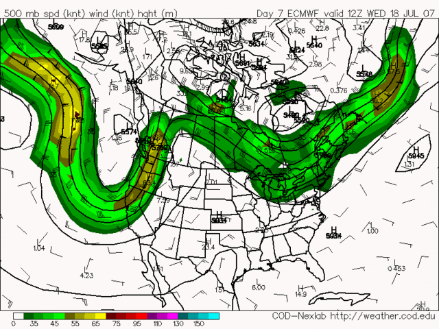
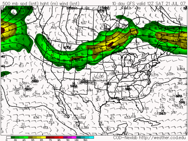
Again, more of the same can be expected. Very little rainfall is being forecast by the models. In fact, look at the following images that I am posting below. As I talked about in my last blog entry, the storm track looks to remain well off to our North. Both the 12Z Euro and 12Z GFS are in agreement.
12Z Euro valid at 168 Hours (Wed. July 18th)
12Z GFS valid at 240 Hours (Sat. July 21st)
The final image that I would like to show you is another 12Z GFS model image valid at 348 Hours (Wed. July 25th 8pm)
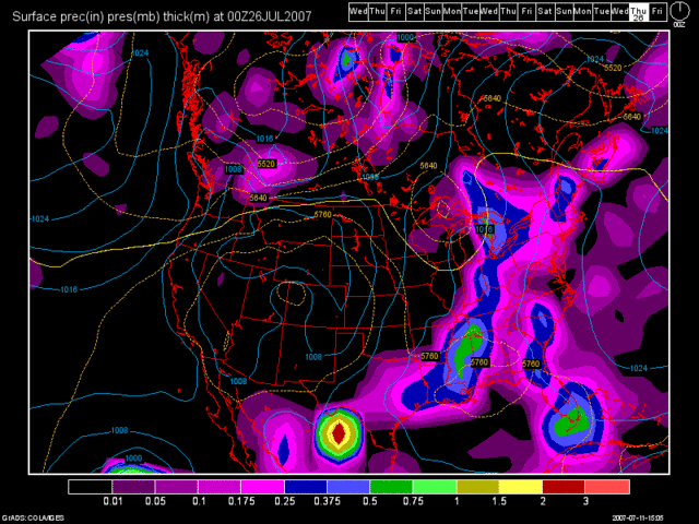
Now, wouldn't it be nice if this cold front actually come thru at this intensity and had that much rainfall with it? Don't count on this occurring folks, as you know, but what the heck, our weather is very boring right now, so I had to post something interesting.
In regards to the Drought, I still think that it'll get worse before it gets better. Even though many areas in the Tri-state have seen some improvement, there is much more rainfall that is needed before we are totally out of it. Northern KY continues to feel the brunt of the drought. Remember, with the Tues/Wed. event, all of the action fell to the North of the OH River. The drought conditions aren't as bad there compared to here in Northern KY, where we saw virtually no rain. There is a good chance that Northern KY may not see much rain, if any, in the next couple of weeks! At the present time, CVG is still almost 7" below normal for the year in rainfall and that deficit will only get much worse with this weather pattern that we are stuck in.

2 comments:
We had quite a bit of rain here this am (early). Rained, at times heavily)for at least an hour.
How much was in the rain gauge? CVG only recorded 0.05" for the event. I hope we got more then that! Please email me or respond here with your report for the Weather Office in regards to precip. amounts. Please check the rain gauge for me.
Thanks!
Post a Comment