Even though today is Saturday, I'd like to wish everyone a Happy Easter!!!
The National Weather Service in Wilmington, OH, (ILN) has issued yet again another Freeze Warning for tonight. A Freeze Watch also continues through Tues. morning. Now, the record low for this morning was again, 19 degrees and CVG only bottomed out at 23. Now for Easter morning, the record low is again 19. ILN is going with lower 20s, and the GFS MOS going with 17! I disagree with that low of 17. The only way we're going to even drop below 20 is if we clear out. I think we will, but how soon will it occur? I think personally, it won't be until after midnight. I'm forecasting a morning low of 21.
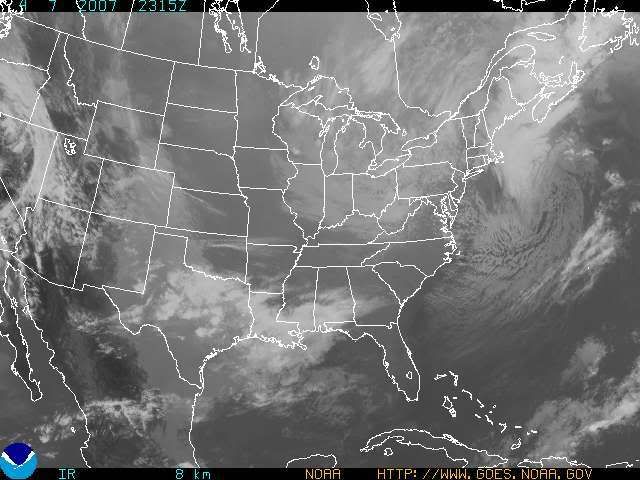
I have posted below a pic of the GOES Satellite for the Eastern US:
You can see where the clearing line is. It's still down in Central KY, but the clouds will begin to slowly disapate now that the sun has set.
A Stormy Week Developing
Taking a look at the 12Z GFS from today, one will see that we have several storm systems to talk about. We'll begin the week with dry conditions on Mon. and for part of Tues. as well. Highs will moderate into the lower 50s both days. The models bring in a threat of rain late in the day on Tues. with showers really developing in earnest Tues. night and Wed. In fact, as the system pulls out Wed. night and early Thurs. morning, we may even see the precip. switch over to some wet snow shower activity during that time! Highs will be the lower 50s both days and lows in the middle 30s.
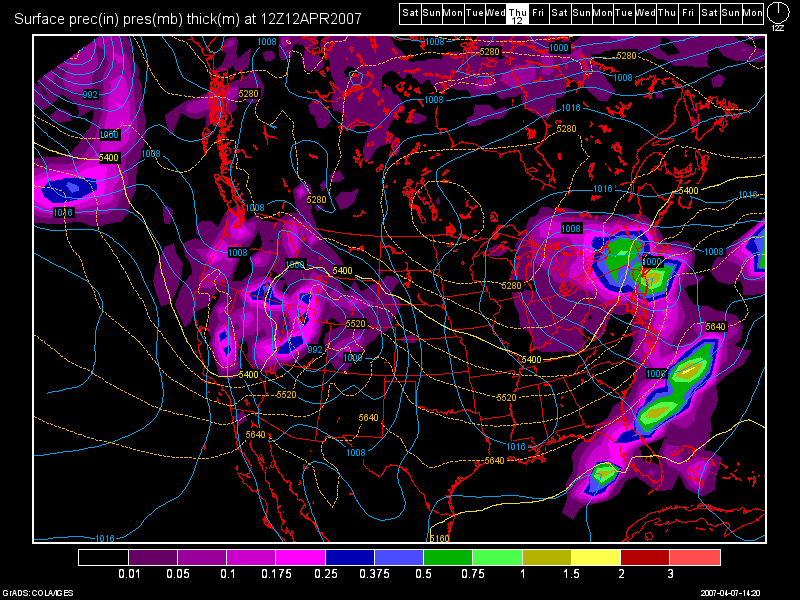
Here is an image of the 12Z GFS Model run from today valid for Thurs. April 12th at 120 hours. This will show you the snow threat. One can easily see that the 540 line is dipping into the TN Valley. I don't see any accumulations here, mind you, but some flurries and snow showers could be flying about the area for early Thurs. morning.
High pressure will briefly build in Thurs. afternoon and Fri. as well. Highs should be pushing 60 on Fri. and finally, by Sat. and Sun. we should see normal highs in the lower 60s, but yet again, here comes another storm system! The 12Z GFS is showing the heaviest rains along and to the South of the OH River. I don't see any severe wx threat with this system either as I think that will be to our South from the TN Valley on Southward.
Long Range Outlook: (April 16-23rd)
I still think overall, however, that our cold streak will continue. Our next major low pressure system will come in around the 17th-20th time frame. It looks like another good soaking rain event on the 17-18th then on the 19th and 20th more flurries and snow showers I think will be possible, if the models hold on to their current thinking.
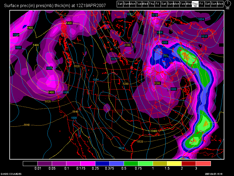
Below, you'll see another 12Z GFS Model run image valid at 288 hours for April 19th:
The model pretty much keeps the 540 line at, or to our South for the rest of the long term period through April 23rd.
Stay tuned for further updates!


4 comments:
I could not agree more. I would be surprised really to see any severe weather with the cold snap we have had. Chances are slim to none. Awesome blog this week, as usual, love the Bunny, and it's not from channel 9 ;) Anyway, I hope you have a great Easter Les, and stay safe!
Thanks Nick, very much! Gice my best to your family, and hope you all have a very Blessed Easter!
Yeah, it's back to trending super cold again, whereas yesterday was warmer. 6Z was warm this morning too, but now 12Z is back to colder. To me, the warmer solutions are outliers.
Happy Easter Les!! The weather here has been just crazy...I cant believe last week was in the 70's and now its freezin...yeah I love snow but its Spring..lol the weather always finds a way to surprise us doesnt it
Happy Easter to you too Martie!
The weather indeed always surprises us! That's why I love it so much! My Grandma in Detroit picked up close to an inch this morning, and there was a guy who lives in Eastern OH, who picked up 5" with Lake Effect Snow! WOW!
Post a Comment