Good afternoon everyone! What a beautiful weekend that we have in progress! We have clear skies all across the OH Valley today and tomorrow as well. The temp. at CVG is already up to 69 degrees as of this post.
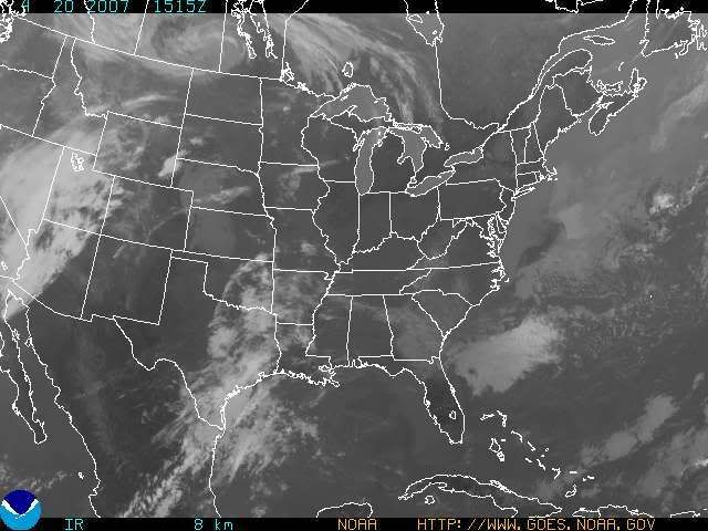
Check out the Satellite picture below. You'll see exactly where the ridge of high pressure is located. The SE US is under a nasty drought right now, with fire weather watches and warnings, plus dense smoke advisories are in effect in some places.

My forecast high for today is 74 and 78 for tomorrow! Speaking of tomorrow, we'll be under mostly sunny skies then as well.
A weak cold front begins to descend upon the area on Mon. afternoon/evening. Until then, we can expect another decent day on Monday with highs in the middle 70s expected! Models have been in good agreement over the last several runs with both the NAM and GFS weakening the front and also stalling it somewhere in the OH Valley. I am inserting a slight chance of a shower or a T-storm with the front's arrival, but moisture does not look to be all that impressive with this front.
On Tues., the front will begin to lift Northward as a warm front. Tues. could be a dry day, but I'll leave a chance of showers and T-storms in the forecast at this point, due to model uncertainty in regards to the position of the front.
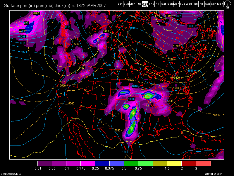
By Wed., a wave of low pressure will develop on the front and head our way. According to the 6Z GFS valid at 108 hours for Wed. afternoon at 2pm, it shows the precip. starting to move into the area with low pressure located in the panhandles of TX and OK and an area of low pressure riding along the front in ILL.

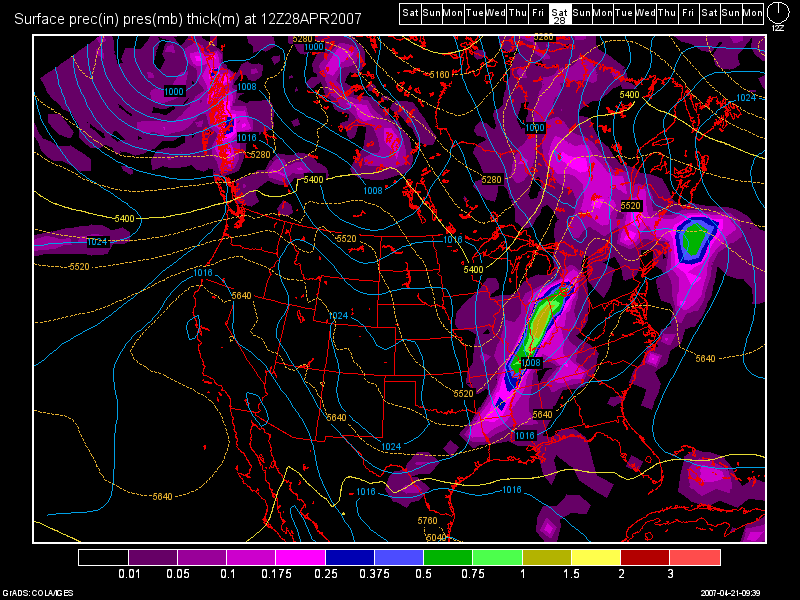
Highs throughout the week will fall into the 60s as we progress thru the rest of the work week. Thurs. thru Sat. at least, I am going to continue to leave in a daily threat of showers and T-storms. Here is another 6Z GFS model image valid at 174 hours for Sat. morning at 8am:

As one can see, the cold front is situated out in Indiana, and it should pass thru the region Sat, night. On Sun. we'll see clearing skies by afternoon with highs both days in the 60s.
Long Range Outlook (April 30th - May 7th)
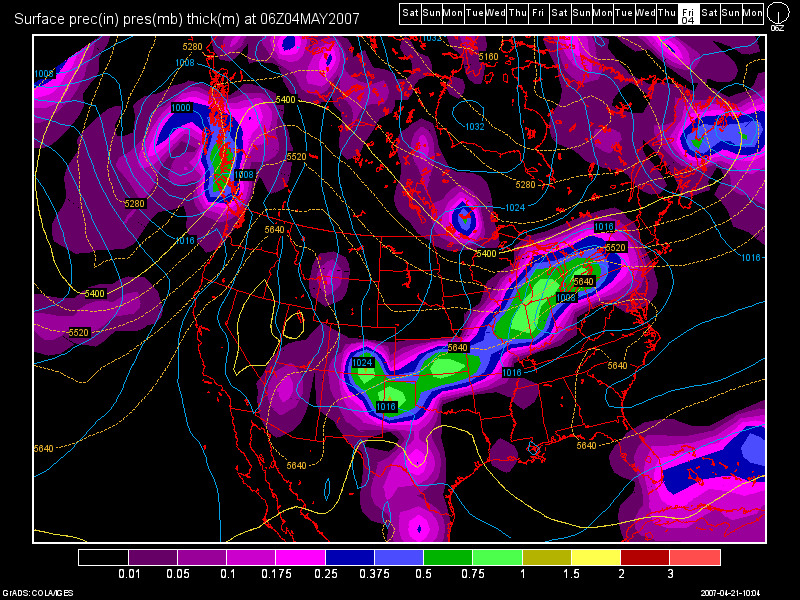
As we begin the month of May, the models are currently showing a few dry days but by May 3rd-4th, another slow moving cold front will be dropping down across the Great Lakes region, and it should push into our region by Fri. night or Sat. (May 4th-5th):

Temps. behind that system should drop into the upper 50s and lower 60s based on this model run. If we do not hit 80 at CVG tomorrow, then I believe my prediction of NOT seeing any 80 degree temps.will come true!
Finally, I'd like to make another announcement...
My friend Trevor who has the USA Weather Forum and Cincy Forecast website, is now doing his own VIDEO Weather Forecasts! The guy does a nice job with graphics and explaining the weather in a way that everyone can understand. Click on the link below to access his forecasts!
http://www.createforum.com/usaweather/viewforum.php?f=18&mforum=usaweather

6 comments:
Looks Nice!
Thanks very much! =)
Awesome as alaways! To bad not much of a severe threat through the next few weeks :-(
We can't rule it oit Nick.. but I agree, at this time severe chances look slim.. but we still need to keep an eye out towards the end of the week as the position of the cold front will be key to who gets the heaviest rains and storms and who gets ripped off!
Id like to request a nice Thunderstorm for the Columbus Area =)
your blogs are awesome as always Les!
Thx Martie, very much! The chances look good for heavy rianfall and isolated T-storms (slim chance for severe) on Wed. and thurs. of this week. My next blof entry will discuss this in a day or two.
Post a Comment