Good morning everyone!
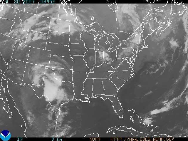
Well, I almost made it through April without an 80 degree temp. at CVG when I made the prediction back on April the 5th. I guess it's proper to have it bust on the last day of the month! All in all though, it was still a great prediction, and to me, it stands out as one of my best long range predictions that I have made in a long, long time. The GFS MOS guidance, shows a high of 83 today, which I agree with. I have posted a satellite image below. As one can see, there is some high cloudiness roaming through the Northern parts of the Tri-state from T-storm blow off. Those clouds will be gone in the next hour or two, leaving most of us with wall-to-wall sunshine for the majority of the day.

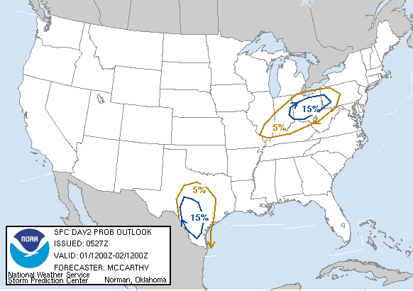
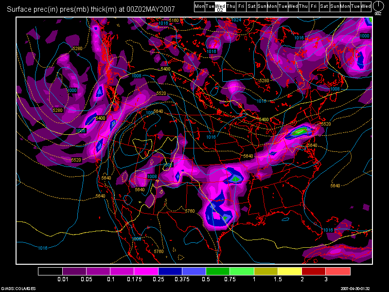
For Tues. there will be a slight risk of severe wx. The surface based CAPES will only be at 1000 j/KG for Cincinnati, with a lifted index of -4 in the afternoon. Both the 0Z NAM and GFS have the front coming through here Tues. evening after 8 or 9pm. The NAM and GFS both have come down on precip. chances for Cincinnati. Thus, I am downplaying the severe threat for us. Right now, I am going for an isolated severe storm with the best chance being along the I-70 Corridor running from Dayton to Columbus.
The SPC Day 2 Outlook graphic is below, which I think illustrates by prediction beautifully.

Here's the 0Z GFS model run valid at 48 hours: (Tues at 8pm)

After this system moves through, Wed - Fri. looks to be dry, although cooler since we'll be under a NW flow aloft. Temps. will drop from the 80s on Tues. down into the upper 60s for Wed. then around 70 to the lower 70s for Thurs and Fri.
By the time we hit next weekend, at this time, it looks to be unsettled in the OH Valley. I've been watching the model runs daily as I know there are a lot of activities planned for that weekend. Here in Cincy, the Flying Pig Marathon will be happening, and right now, my forecast calls for a 30% chance of a T-storm with highs in the 70s. Now, a ridge of high pressure will be building down from the Great Lakes by weeks end, and if it pushes far enough South, and if the front can push itself far enough South, then for the Marathon, conditions could be dry. For the Walleye Tournament on Lake Erie, right now, I am calling for dry conditions all weekend with NW Winds. Highs up there should be in the upper 60s on Sat to the lower 70s on Sun under sunny skies!
Long Range Outlook: (May 6th - May 15th)
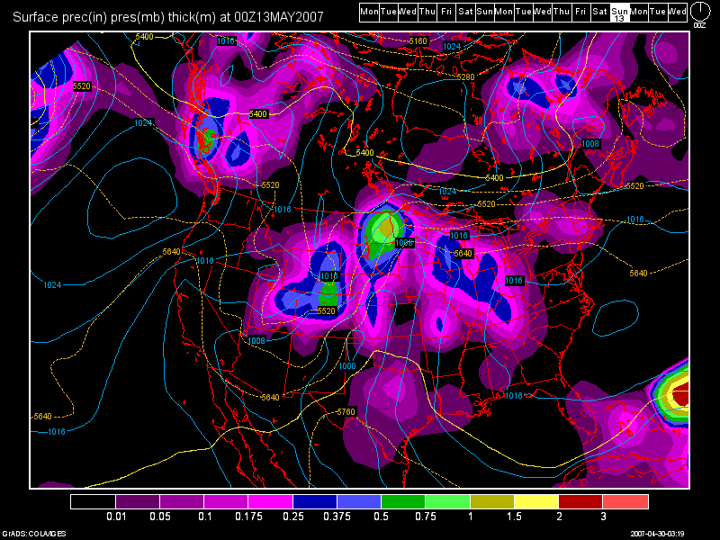
Conditions during the long range period look to be fairly mild across the region. A cold front is forecast to come through the region on May 9th, but it looks weak at this time. A stronger cold front looks to affect the region around the May 12th time frame.
Here's the 0Z GFS Model Run image below valid at 312 hours: (Sat., May 12th at 8pm)

Then, another front could affect the region by the end of the long term period.

4 comments:
Its already 71 here at 11:30am...Its def lookin like a pretty warm day...Is Tuesday gonna be a really bad storm..I know you said severe..but I dont really know what that means when it comes to weather...to me..severe is a tornado...or do you just mean a storm with alota thunder and lightning goin on?
what makes a storm severe?
It's 79 here as of the noon update. The best chance of severe wx to me is in your area. A severe storm is classified as one that contains hail 3/4" in diameter or larger.... winds over 58mph.. or a tornado. I'll continue to monitor for you. No need to worry yet at this time.
Awesome as always. Martie, as long as you keep your eye on the sky and local news channels, you will be safe. The people who are killed or hurt in a Severe T-Storm are usually the one's who chase em. Or like me, go outside and watch them. I am not sure as of right now for the Cincinnati area and severe wx. The SPC thinks that the models are overplaying this.. Well, at least the NAM, but depending on tomorrow, they may bump us up to a Moderate Risk. That will be our second of the year if they do. But, it seems to me whenever they do that they jinx us, and you guys knowing the big scardey cat I am, I hope they do. Oh well, I guess we will have to wait and see til tomorrow morning rolls around to find out. Hit 83° here in Blanchester today. I luffed the warm air..
For highs... CVG recorded 85 today and here at the Weather Office I had 89.1. The SPC has upgraded the probability to 30% now, with the best chance still being in Ohio. I may get ripped off again this time. I'll check the model runs tomorrow morning and will probably send out an email update then. Thanks once again Nick for leaving a comment! =)
Post a Comment